Category:Maps of Patagonia
Jump to navigation
Jump to search
Wikimedia category | |||||
| Upload media | |||||
| Instance of | |||||
|---|---|---|---|---|---|
| Category combines topics | |||||
| Patagonia | |||||
region located at the southern end of South America | |||||
| Instance of | |||||
| Location | |||||
 | |||||
Subcategories
This category has the following 11 subcategories, out of 11 total.
D
F
M
Media in category "Maps of Patagonia"
The following 75 files are in this category, out of 75 total.
-
0 3459 Südküste Chiles.jpg 2,499 × 1,660; 2.78 MB
-
1893 border protocol between Argentina & Chile.svg 694 × 589; 916 KB
-
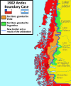
1902 Andes Boundary Case de.svg 537 × 645; 1.02 MB
-
1902 Andes Boundary Case.svg 1,430 × 1,720; 1.47 MB
-
2023 FIBA Basketball World Cup Argentina-Uruguay bid venues.svg 587 × 784; 2 MB
-
A voyage round the world, in the years MDCCXL, I, II, III, IV Fleuron T089477-3.png 1,709 × 1,771; 116 KB
-
Araucania Patagonia.PNG 520 × 1,004; 12 KB
-
Aysén location map (+claims, 1974-1995) Laguna del Desierto included.svg 300 × 397; 1.1 MB
-
Aysén location map (1974-1995) Laguna del Desierto Disputed.svg 300 × 397; 1.08 MB
-
Baselines chile.png 1,653 × 1,787; 894 KB
-
Biomap Mara Patagonica.png 800 × 370; 42 KB
-
BOSQUESsubantarticosARGENTINA.JPG 227 × 411; 9 KB
-
BosquesubantarticosArgentina.JPG 227 × 411; 9 KB
-
Carretera Austral.png 1,100 × 2,136; 884 KB
-
Cile australe map a.png 474 × 909; 325 KB
-
Collón Curá Formation.jpg 4,554 × 5,768; 5.69 MB
-
Conflicto del Beagle.svg 1,355 × 772; 1.9 MB
-
CroquisElJuncal1924.jpg 1,074 × 784; 121 KB
-
Descriptionis Ptolemaicæ avgmentvm siue Occidentis notitia breui commentario illustrata p117.tif 6,234 × 4,799; 85.62 MB
-
Disputa de la Laguna del Desierto.svg 1,205 × 1,063; 2.62 MB
-
Disputa limítrofe de Alto Palena.svg 1,772 × 2,776; 1.29 MB
-
Dispute sur le Laguna del Desierto.svg 1,205 × 1,063; 2.65 MB
-
División departamental de la Zona Militar Comodoro Rivadavia.svg 710 × 484; 717 KB
-
FalklandsPatagoniaGeography.svg 1,262 × 692; 1.25 MB
-
FalklandsPatagoniaGeography2.pdf 2,102 × 1,152; 1.18 MB
-
Imagen ubicacion ria Deseado.png 1,801 × 1,364; 148 KB
-
Islas del Atlántico Sur department.PNG 1,184 × 1,068; 447 KB
-
Kap Hoorn vs Magellanstr.jpg 2,200 × 1,650; 1.27 MB
-
Laguna del Desierto dispute.svg 1,205 × 1,063; 2.65 MB
-
Laudo limítrofe entre Argentina y Chile de 1902.svg 1,430 × 1,720; 1.51 MB
-
Límites Campo de Hielo Patagónico Sur antes de 1994.svg 935 × 1,641; 2.62 MB
-
Límites Campo de Hielo Patagónico Sur.svg 935 × 1,641; 2.73 MB
-
Magallanes y Antártica Chilena location map (South American part) (+claims).svg 1,535 × 1,550; 830 KB
-
Magallanes y Antártica Chilena location map (South American part) (+claims, 1974).svg 1,535 × 1,550; 1.15 MB
-
Magallanes y Antártica Chilena location map (South American part).svg 1,535 × 1,550; 831 KB
-
Map of Patagonia from 'Llawlyfr y Wladychfa Gymreig'.jpg 788 × 1,000; 127 KB
-
Map of the Viceroyalty of Peru (+claimed Patagonian and Amazonic territories).svg 3,121 × 1,586; 1.68 MB
-
Map showing the Santa Cruz Province.svg 765 × 990; 579 KB
-
Map-Northern Patagonia-Argentina-political.png 1,731 × 1,218; 663 KB
-
Map-Northern Patagonia-Argentina-topologycal.png 1,754 × 1,240; 1.27 MB
-
Mapa Ap Iwan.jpg 5,692 × 6,858; 2.1 MB
-
Mapa de la Provincia de Patagonia (1955-1996).svg 465 × 1,085; 544 KB
-
Mapa general de la Patagonia.svg 750 × 1,041; 768 KB
-
Mapa Nahuel Huapi.svg 744 × 1,052; 120 KB
-
Neotropic-South-Argentina-AGS.svg 1,418 × 2,412; 2.36 MB
-
Pat map.PNG 519 × 707; 23 KB
-
Patagonia aayushi.jpg 2,784 × 3,499; 1.53 MB
-
Patagonia Argentina.png 270 × 459; 49 KB
-
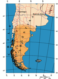
Patagonia rg.png 1,400 × 1,400; 147 KB
-
Patagonia.png 435 × 385; 227 KB
-
Patagonia1.png 582 × 990; 28 KB
-
Patagonien Geländeklassen.png 758 × 1,368; 406 KB
-
Patagonien001.png 1,200 × 1,676; 337 KB
-
Patagonien002.png 1,418 × 1,676; 272 KB
-
PER 2007 Karte.jpg 800 × 1,131; 732 KB
-
Protocolo de límites de 1893 entre Argentina y Chile.svg 694 × 589; 929 KB
-
Pueblos indígenas de la Patagonia Austral.svg 1,535 × 1,550; 881 KB
-
Pérdidas territoriales de iure de la República de Chile.svg 1,800 × 2,808; 3.84 MB
-
RT-Location-Map B&W.jpg 1,678 × 1,188; 184 KB
-
Seale-1744.png 800 × 587; 656 KB
-
Southern Patagonian Ice Field border.svg 935 × 1,641; 2.64 MB
-
Southern Patagonian Ice Field dispute before 1994.svg 935 × 1,641; 2.45 MB
-
Territorial losses of the Republic of Chile de jure.svg 1,800 × 2,808; 3.75 MB
-
Tierra del Fuego location map.svg 1,535 × 1,550; 824 KB
-
Tierras Magallánicas o Chile Moderno en la Capitanía General de Chile.svg 1,710 × 2,679; 2.57 MB
-
TopographicMapOfPatagoniaByAlbertoMariaDeAgostini.jpg 5,712 × 3,746; 5.03 MB
-
Torres del Paine National Park location.svg 1,616 × 1,600; 1.46 MB
-
Trapananda, Reino de Chile.svg 533 × 533; 4.54 MB
-
Ubicacion Bahia de los Nodales.png 1,654 × 1,654; 53 KB
-
Ubicacion de bahia del oso marino.png 1,654 × 1,654; 43 KB
-
Παγετώνας Περίτο Μορένο.jpg 574 × 384; 99 KB


