Category:Maps of the history of Ternopil Oblast
Jump to navigation
Jump to search
Regions of Ukraine:
Oblasts: Cherkasy · Dnipropetrovsk · Donetsk · Kharkiv · Kherson · Kyiv · Kirovohrad · Luhansk · Lviv · Odesa · Ternopil · Zakarpattia · Zaporizhzhia · – Cities: – Autonomous Republic: Crimea
Oblasts: Cherkasy · Dnipropetrovsk · Donetsk · Kharkiv · Kherson · Kyiv · Kirovohrad · Luhansk · Lviv · Odesa · Ternopil · Zakarpattia · Zaporizhzhia · – Cities: – Autonomous Republic: Crimea

| NO WIKIDATA ID FOUND! Search for Maps of the history of Ternopil Oblast on Wikidata | |
| Upload media |
Subcategories
This category has only the following subcategory.
T
- Maps of Tarnopol Voivodeship (28 F)
Media in category "Maps of the history of Ternopil Oblast"
The following 17 files are in this category, out of 17 total.
-
 Deutsche Siedlungen in Galizien 1913.jpg 3,000 × 1,920; 3.22 MB
-
 Galicia 1897 Jaslowiec.jpg 532 × 449; 326 KB
-
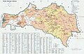
 Galicia administrative1914.jpg 598 × 450; 155 KB
-
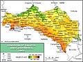
 Galicia physical1914-de.png 598 × 450; 169 KB
-
 Galizien Israeliten 1910 ES.svg 1,075 × 700; 491 KB
-
 Galizien Israeliten 1910-hu.svg 1,075 × 700; 106 KB
-
 Galizien Israeliten 1910.svg 1,075 × 700; 91 KB
-
 Halič, Židé 1910.svg 1,075 × 700; 191 KB
-
 Map of Northwestern Ukraine, Korduba, 1917.jpg 994 × 1,394; 1.34 MB
-
 Map of the Kingdom of Galicia, 1914.jpg 598 × 450; 157 KB
-
 Podolvoevod.jpg 673 × 489; 79 KB
-
 UPA-structure.PNG 780 × 570; 498 KB
-
 Podrecznik geografii ojczystej 1894 (117388849) (cropped).jpg 3,078 × 2,152; 1.32 MB
-
 Podrecznik geografii ojczystej 1894 (117388849).jpg 4,264 × 3,060; 2.14 MB
-
 Володіння Боговитинів на Волині.png 1,277 × 1,040; 417 KB
-
 МВ1 001.jpg 4,656 × 3,391; 1.56 MB
-
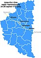 Шлях Юст Юля через Тернопільщину 24-28 серпня 1711 року.jpg 559 × 800; 155 KB


_(cropped).jpg)
.jpg)


