Category:Maps of the history of Odesa Oblast
Jump to navigation
Jump to search
Regions of Ukraine:
Oblasts: Cherkasy · Dnipropetrovsk · Donetsk · Kharkiv · Kherson · Kyiv · Kirovohrad · Luhansk · Lviv · Odesa · Ternopil · Zakarpattia · Zaporizhzhia · – Cities: – Autonomous Republic: Crimea
Oblasts: Cherkasy · Dnipropetrovsk · Donetsk · Kharkiv · Kherson · Kyiv · Kirovohrad · Luhansk · Lviv · Odesa · Ternopil · Zakarpattia · Zaporizhzhia · – Cities: – Autonomous Republic: Crimea
Subcategories
This category has the following 10 subcategories, out of 10 total.
B
I
M
O
P
Media in category "Maps of the history of Odesa Oblast"
The following 48 files are in this category, out of 48 total.
-
 33- Одеса, Миколаїв, Херсон (1921 рік).jpg 4,140 × 3,373; 1.98 MB
-
 Ananiew - 48-48.jpg 3,427 × 4,982; 2.37 MB
-
 Balta - 47-48.jpg 3,397 × 4,994; 2.64 MB
-
 Ethnic map of Cetatea Alba County 1930.png 2,584 × 2,411; 1.42 MB
-
 Ethnic map of Ismail County 1930.png 3,026 × 1,541; 1.01 MB
-
 Fra mauro map fiordelixe black sea.jpg 1,440 × 900; 373 KB
-
 Großliebenthaler Kolonien Odessa.svg 613 × 482; 404 KB
-
 Hannowka Region ethnische Verteilung 1907.jpg 744 × 372; 307 KB
-
 Hoffnungstal Bessarabien 1907.jpg 585 × 525; 351 KB
-
 Hofplan Bessarabien.svg 366 × 515; 39 KB
-
 Insula Carolina.png 1,091 × 838; 583 KB
-
 Izmail Oblast.png 900 × 850; 498 KB
-
 Katarzy - 48-47.jpg 3,458 × 4,987; 2.28 MB
-
 L-36-50-V (ODESSA) 1929.jpg 9,999 × 9,485; 18.64 MB
-
 LI(50).jpg 9,434 × 6,800; 14.97 MB
-
 Liberation of Odessa region and Pridnestrovie.jpg 739 × 618; 157 KB
-
 Nogay Jedisan Orda Map published in Vienna in circa 1790.JPG 2,592 × 1,944; 2.3 MB
-
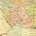
 Odesa obl-adm ustr.jpg 530 × 769; 93 KB
-
 Odesa rayons.svg 888 × 1,231; 554 KB
-
 Odesa regions-EN.svg 888 × 1,231; 469 KB
-
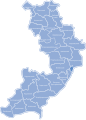 Odesa regions.svg 888 × 1,231; 560 KB
-
 Odesa-Raion.png 296 × 410; 53 KB
-
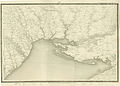
 Odessa und umgegend map late XIX century.JPG 3,264 × 2,448; 2.78 MB
-
 OdessaSovietRep.real.png 519 × 367; 121 KB
-
 OdessaSovietRepublic.png 519 × 367; 109 KB
-
 Plan d'Odessa et d'une partie de ses environs (34167567590).jpg 9,618 × 6,895; 38.48 MB
-
 Plan Glueckstal.jpg 807 × 942; 62 KB
-
 Plan Grossliebental.jpg 865 × 993; 125 KB
-
 Tatarbunar (ethnic).JPG 2,400 × 3,965; 2.81 MB
-
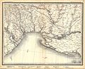
 The Balkans. Odessa. Sheet R-66.jpg 4,102 × 4,943; 5.01 MB
-
 USSR map NL 36-4 Odessa.jpg 5,699 × 4,361; 7.22 MB
-
 Город Балта (карта 1860-х годов).jpg 856 × 453; 127 KB
-
 Город Татар-Бунар (карта 1860-х годов).png 703 × 491; 434 KB
-
 Григорівський десант.jpg 978 × 744; 651 KB
-
 Клястиц.jpg 585 × 525; 148 KB
-
 Колишня Одеська губернія 1928.jpg 1,900 × 1,900; 2.53 MB
-
 Майбутня Одеська область 1932.jpg 1,763 × 1,763; 2.12 MB
-
 Одеська губернія 1923.jpg 2,298 × 2,298; 3.98 MB
-
 Одеська Миколаївська Ізмаїльська області 1947.jpg 4,778 × 4,778; 11.79 MB
-
 Одеська область 1932.jpg 1,198 × 1,198; 1.21 MB
-
 Одеська область 1937.jpg 1,325 × 1,325; 1.19 MB
-
 Одеська та Миколаївська області 1938.jpg 1,888 × 1,888; 2.74 MB
-
 Пгт Черноморское Одесской области 2.2.JPG 1,913 × 1,081; 626 KB
-
 План села.jpg 1,248 × 1,616; 337 KB
-
 Село Стара Царичанка 1772.jpg 611 × 650; 79 KB
-
 Станция Раздельная на военно-топографической карте Российской Империи.png 1,588 × 927; 1.17 MB
-
 Станция Раздельная на карте Тираспольского уезда.png 1,168 × 889; 1.82 MB
-
 오데사소비에트공화국.png 519 × 367; 87 KB
.jpg)


_1929.jpg)
.jpg)


.jpg)


.JPG)


.jpg)
.png)


