Category:Maps of the history of South India
Jump to navigation
Jump to search
States of India: Andhra Pradesh · Assam · Goa · Himachal Pradesh · Karnataka · Kerala · Maharashtra · Tamil Nadu · Telangana · West Bengal
Union territories: Dadra and Nagar Haveli and Daman and Diu · Delhi · Jammu and Kashmir · Ladakh · Puducherry
Former states of India:
Former union territories:
Union territories: Dadra and Nagar Haveli and Daman and Diu · Delhi · Jammu and Kashmir · Ladakh · Puducherry
Former states of India:
Former union territories:
Subcategories
This category has the following 15 subcategories, out of 15 total.
Media in category "Maps of the history of South India"
The following 38 files are in this category, out of 38 total.
-
 A map of burial field of Brahmagiri.jpg 1,490 × 1,816; 129 KB
-
 Cities caves and ancient sites of middle and south india.JPG 802 × 610; 105 KB
-
 Deccan1956.PNG 1,950 × 2,159; 593 KB
-
 Franska handelsstationer i indien.jpg 227 × 173; 5 KB
-
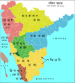
 Karnataka 1956 Reorg ta.svg 693 × 748; 301 KB
-
 Karnataka 1956 Reorg-bn.svg 693 × 748; 301 KB
-
 Karnataka 1956 Reorg-fr.svg 672 × 746; 279 KB
-
 Karnataka 1956 Reorg-gu.svg 693 × 748; 249 KB
-
 Karnataka 1956 Reorg-hi.svg 693 × 748; 691 KB
-
 Karnataka 1956 Reorg-kn.svg 693 × 748; 301 KB
-
 Karnataka 1956 Reorg-mr.svg 693 × 748; 691 KB
-
 Karnataka 1956 Reorg-pa.svg 693 × 748; 295 KB
-
 Karnataka 1956 Reorg-te.svg 693 × 748; 322 KB
-
 Karnataka 1956 Reorg.od.svg 693 × 748; 320 KB
-
 Karta sodra indien 1500-es.svg 917 × 957; 1.97 MB
-
 Karta sodra indien 1500.jpg 300 × 381; 17 KB
-
 Kumari Kandam map.png 572 × 386; 341 KB
-
 Mahishaka kingdom.jpg 1,002 × 1,176; 286 KB
-
 Map of five Indian regions of Haiguotuzhi.jpg 1,852 × 1,600; 1.05 MB
-
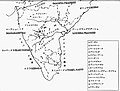
 South India in 300 CE.jpg 804 × 563; 62 KB
-
 South India in Ad 01.jpg 1,800 × 1,200; 352 KB
-
 South India in AD 1200,.jpg 1,800 × 1,200; 289 KB
-
 South India in AD 300.jpg 1,800 × 1,200; 390 KB
-
 South India in AD 600.jpg 1,800 × 1,200; 309 KB
-
 South India in AD 700.jpg 1,800 × 1,200; 321 KB
-
 South India in AD 800.jpg 1,800 × 1,200; 308 KB
-
 South India in AD 900.jpg 1,800 × 1,200; 167 KB
-
 South India.png 1,503 × 1,687; 390 KB
-
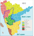
 South Indian territories 2009 de.svg 693 × 748; 732 KB
-
 South Indian territories 2009-fr.svg 672 × 746; 283 KB
-
 South Indian territories de.svg 693 × 748; 697 KB
-
 South Indian territories-fr.svg 672 × 746; 267 KB
-
 South Indian territories.svg 672 × 746; 306 KB
-
 The Central and Southern India map of Haiguotuzhi.jpg 2,555 × 1,598; 1.48 MB
-
 The Eastern India map of Haiguotuzhi.jpg 918 × 1,632; 600 KB
-
 The evolution of the the Southeast Asia and India map of Haiguotuzhi.jpg 1,491 × 1,574; 746 KB
-
 Thinai en.svg 649 × 535; 13 KB
-
 Thinai-തിണകൾ.svg 649 × 535; 13 KB


