Category:Maps of the history of Andhra Pradesh
Jump to navigation
Jump to search
States of India: Andhra Pradesh · Assam · Goa · Himachal Pradesh · Karnataka · Kerala · Maharashtra · Tamil Nadu · Telangana · West Bengal
Union territories: Dadra and Nagar Haveli and Daman and Diu · Delhi · Jammu and Kashmir · Ladakh · Puducherry
Former states of India:
Former union territories:
Union territories: Dadra and Nagar Haveli and Daman and Diu · Delhi · Jammu and Kashmir · Ladakh · Puducherry
Former states of India:
Former union territories:
Subcategories
This category has the following 7 subcategories, out of 7 total.
B
C
- Maps of the Chalukya Empire (18 F)
M
- Maps of Madras Presidency (11 F)
P
- Maps of the Pandyan Dynasty (12 F)
S
Media in category "Maps of the history of Andhra Pradesh"
The following 12 files are in this category, out of 12 total.
-
Archaeological Museums map of Andhra Pradesh.png 923 × 881; 167 KB
-
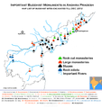
Buddhist sites Map of Andhra Pradesh.png 1,181 × 1,254; 399 KB
-
Chalukya territories lg.png 612 × 421; 105 KB
-
Extent of the Satavahanas.png 1,027 × 909; 196 KB
-
Holy relic sites map of Andhra Pradesh.jpg 1,563 × 1,464; 1.19 MB
-
Kalinga-es.svg 722 × 759; 364 KB
-
Kalinga.GIF 400 × 337; 10 KB
-
Karnataka 1947.jpg 534 × 675; 75 KB
-
Madras in India (1951).svg 980 × 1,182; 200 KB
-
Major Buddhist heritage sites of North coastal Andhra.png 1,600 × 1,287; 342 KB
-
Pre Historic Mid Krishna-Tungabhadra Valley sites.jpg 2,338 × 1,932; 876 KB
-
Western-ganga-empire-map.svg 1,651 × 1,753; 430 KB


