Category:Maps of the Kingdom of Mysore
Jump to navigation
Jump to search
Subcategories
This category has only the following subcategory.
A
Media in category "Maps of the Kingdom of Mysore"
The following 30 files are in this category, out of 30 total.
-
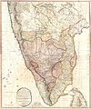
1793 Faden Wall Map of India - Geographicus - India-faden-1793.jpg 6,000 × 7,229; 9.83 MB
-
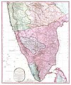
1800 Faden Rennell Wall Map of India - Geographicus - India-faden-1795.jpg 6,000 × 7,353; 10.85 MB
-
1800 Map of Peninsular India-1795.jpg 5,936 × 7,137; 50.39 MB
-
1801 - 20 - 28 1809 Northern and Eastern Provinces of Mysore.jpg 17,424 × 17,531; 18.26 MB
-
1801 - 20 - 28(A) Mysore.jpg 17,536 × 19,310; 16.97 MB
-
1801 - 20 - 30 Territories of Mysore.jpg 14,167 × 11,329; 8.72 MB
-
Battle of the Golden Rocks.jpg 5,053 × 4,850; 14.64 MB
-
Gold mysore.jpg 3,063 × 2,156; 6.93 MB
-
HyderAliDominions1780max.jpg 875 × 1,252; 264 KB
-
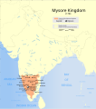
Indian Mysore Kingdom 1784 map-es.svg 1,639 × 1,852; 2.44 MB
-
Indian Mysore Kingdom 1784 map.svg 1,639 × 1,852; 476 KB
-
Kingdom of Mysore Flap Map.png 454 × 546; 135 KB
-
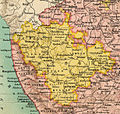
Madras Prov South 1909 Mysore.jpg 613 × 580; 230 KB
-
Madras Prov South 1909.jpg 1,000 × 1,246; 430 KB
-
Malabar district.jpg 689 × 565; 107 KB
-
Map of mysore from "Historical Atlas of India," by Charles Joppen.jpg 600 × 873; 120 KB
-
Map of Mysore in 1704.jpg 866 × 1,270; 279 KB
-
Mysore from 1617 through 1799.jpg 2,608 × 1,585; 647 KB
-
Mysore from 1st to 9th century.jpg 2,592 × 1,482; 588 KB
-
Mysore in 1130.jpg 2,592 × 1,482; 540 KB
-
Mysore in 1625.jpg 2,592 × 1,482; 517 KB
-
Mysore in 1704 Joppen.jpg 880 × 1,280; 246 KB
-
Mysore State in British India 1940.png 1,621 × 1,469; 85 KB
-
Mysore state.jpg 596 × 488; 74 KB
-
Mysore.JPG 434 × 356; 8 KB
-
Mysore1893.jpg 938 × 669; 491 KB
-
Plate 34. Sect. XIII- Madras, Mysore and Goa maps from Constable 1893 Hand Atlas.jpg 1,736 × 1,376; 830 KB
-
South India Map 1794.jpg 3,400 × 4,608; 2.59 MB
-
SouthIndia1704SubrahCIA2001.jpg 951 × 549; 104 KB
-
Wikipedia OldMysore.jpg 1,200 × 840; 267 KB
