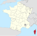
Category:Maps of the history of Corsica
Jump to navigation
Jump to search
Administrative regions and territorial collectivity of Metropolitan France (‡ since start of 2016):
Auvergne-Rhône-Alpes‡ · Bourgogne-Franche-Comté‡ · Brittany · Centre-Val de Loire · Corsica · Grand Est‡ · Hauts-de-France‡ · Île-de-France · Normandy‡ · Occitania‡ · Provence-Alpes-Côte d'Azur
Former administrative regions of Metropolitan France (until end of 2015):
Alsace · Auvergne · Burgundy · Franche-Comté · Lorraine · Lower Normandy · Upper Normandy · Picardy · Rhône-Alpes
Overseas departments and regions: Guadeloupe · Réunion
Media in category "Maps of the history of Corsica"
The following 12 files are in this category, out of 12 total.
-
France 1552 to 1798-en.png 800 × 600; 40 KB
-
CarthageMap.png 770 × 447; 106 KB
-
CarthageMapDe.png 770 × 447; 106 KB
-
CarthageMapFr.png 770 × 447; 114 KB
-
CarthageMapZh.png 770 × 447; 105 KB
-
Corse in France (1789).svg 2,000 × 1,922; 1.05 MB
-
Corsica SPQR.png 1,600 × 1,096; 42 KB
-
Diocèse Nebbio 1789.svg 2,000 × 1,922; 801 KB
-
Pievi corsica 1730.png 424 × 600; 59 KB
-
Province de Gênes 1789.svg 2,000 × 1,922; 787 KB
-
Province de Pise 1789.svg 2,000 × 1,922; 787 KB
-
Roman Sardinia et Corsica province map la.svg 2,569 × 5,370; 10.63 MB


