Category:Maps of the history of Auvergne
Jump to navigation
Jump to search
Administrative regions and territorial collectivity of Metropolitan France (‡ since start of 2016):
Auvergne-Rhône-Alpes‡ · Bourgogne-Franche-Comté‡ · Brittany · Centre-Val de Loire · Corsica · Grand Est‡ · Hauts-de-France‡ · Île-de-France · Normandy‡ · Occitania‡ · Provence-Alpes-Côte d'Azur
Former administrative regions of Metropolitan France (until end of 2015):
Alsace · Auvergne · Burgundy · Franche-Comté · Lorraine · Lower Normandy · Upper Normandy · Picardy · Rhône-Alpes
Overseas departments and regions: Guadeloupe · Réunion
Use the appropriate category for maps showing all or a large part of Auvergne. See subcategories for smaller areas:
| If the map shows | Category to use |
|---|---|
| Auvergne on a recently created map | Category:Maps of Auvergne or its subcategories |
| Auvergne on a map created more than 70 years ago | Category:Old maps of Auvergne or its subcategories |
| the history of Auvergne on a recently created map | Category:Maps of the history of Auvergne or its subcategories |
| the history of Auvergne on a map created more than 70 years ago | Category:Old maps of the history of Auvergne or its subcategories |

Media in category "Maps of the history of Auvergne"
The following 4 files are in this category, out of 4 total.
-
 Auvergne - Province.jpg 2,884 × 1,472; 1.6 MB
-
 Auvergne in France (1789).svg 2,000 × 1,922; 1.05 MB
-
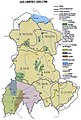 Carte Auvergne historique.jpg 505 × 750; 60 KB
-
 Carte de l'Auvergne.svg 1,457 × 1,626; 747 KB

.svg)

