Category:Maps of the history of Bretagne
Jump to navigation
Jump to search
Administrative regions and territorial collectivity of Metropolitan France (‡ since start of 2016):
Auvergne-Rhône-Alpes‡ · Bourgogne-Franche-Comté‡ · Brittany · Centre-Val de Loire · Corsica · Grand Est‡ · Hauts-de-France‡ · Île-de-France · Normandy‡ · Occitania‡ · Provence-Alpes-Côte d'Azur
Former administrative regions of Metropolitan France (until end of 2015):
Alsace · Auvergne · Burgundy · Franche-Comté · Lorraine · Lower Normandy · Upper Normandy · Picardy · Rhône-Alpes
Overseas departments and regions: Guadeloupe · Réunion
Use the appropriate category for maps showing all or a large part of Brittany. See subcategories for smaller areas:
| If the map shows | Category to use |
|---|---|
| Brittany on a recently created map | Category:Maps of Bretagne or its subcategories |
| Brittany on a map created more than 70 years ago | Category:Old maps of Bretagne or its subcategories |
| the history of Brittany on a recently created map | Category:Maps of the history of Bretagne or its subcategories |
| the history of Brittany on a map created more than 70 years ago | Category:Old maps of the history of Bretagne or its subcategories |

Subcategories
This category has the following 7 subcategories, out of 7 total.
Media in category "Maps of the history of Bretagne"
The following 76 files are in this category, out of 76 total.
-
 Alet e diocesi di Saint Malo.jpg 440 × 317; 57 KB
-
 Bourg de Guimaëc, limitrophe de Lanmeur.jpg 457 × 495; 124 KB
-
 BreizhEveches.png 228 × 206; 4 KB
-
 Bretagne - Brittany.jpg 2,554 × 2,160; 1.59 MB
-
 Bretagne historique 2.png 526 × 556; 34 KB
-
 Bretagne in France (1789).svg 2,000 × 1,922; 1.05 MB
-
 BretagneVTX.jpg 2,573 × 1,997; 1.01 MB
-
 Britonen6JHundert.png 1,670 × 2,928; 441 KB
-
 C. 1150 France, Lotharingia and Burgundy.jpg 2,979 × 3,931; 4.77 MB
-
 C. 1184 France and English Possesions.jpg 1,328 × 1,305; 2.25 MB
-
 C. 1223 France.jpg 1,352 × 1,252; 977 KB
-
 C. 1279 France.jpg 2,979 × 3,931; 4.38 MB
-
 C. 1429 France.jpg 3,890 × 3,010; 4.27 MB
-
 C. 1453 France.jpg 1,458 × 1,202; 1.55 MB
-
 C. 1490 France and England.jpg 811 × 1,252; 1.26 MB
-
 C. 1494 France.jpg 1,379 × 1,337; 1.24 MB
-
 C. 1575 France (Northern).jpg 2,206 × 1,275; 3.11 MB
-
 C. 800 Carolingian Empire.jpg 2,204 × 1,880; 2.98 MB
-
 Capitation 1720.jpg 366 × 559; 181 KB
-
 Carte 1- Le maître de Tronoën.png 866 × 645; 188 KB
-
 Carte Campagne 1488.png 1,230 × 942; 202 KB
-
 Carte du pays des juloded.jpg 1,337 × 1,054; 308 KB
-
 Carte seigneurie de Bréal.jpg 845 × 699; 118 KB
-
 Central Europe 5th Century.jpg 1,088 × 763; 457 KB
-
 County of Nantes-ru.jpg 554 × 446; 127 KB
-
 Cultures en europe de l'ouest.png 1,152 × 1,477; 76 KB
-
 Densités population Bretagne 1910.jpg 360 × 332; 129 KB
-
 Dialectes Breton.png 459 × 345; 36 KB
-
 Diorren an hañvlec'hioù e Breizh.svg 1,052 × 744; 1.49 MB
-
 Domaine ducal de Bretagne sous le règne de Jean V-es.svg 1,668 × 1,452; 388 KB
-
 Domaine ducal de Bretagne sous le règne de Jean V-fr.svg 1,668 × 1,452; 236 KB
-
 Domaines des Rohan en Bretagne.png 960 × 720; 293 KB
-
 Dregantad anvioù-lec'h brezhonek.svg 1,064 × 794; 3.04 MB
-
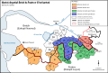
 Duchy of Britanny.png 891 × 899; 23 KB
-
 Développement des stations balnéaires de Bretagne map-fr.svg 1,052 × 744; 1.49 MB
-
 Ecole de pont-croix carte.png 1,034 × 816; 37 KB
-
 Evêchés bretons Pitre-Chevalier.jpg 1,718 × 1,087; 1.33 MB
-
 Forteresses marches de Bretagne.png 2,126 × 1,535; 378 KB
-
 Fortifications after Raid on Lorient 1746 map-fr.svg 1,190 × 793; 823 KB
-
 Frontière linguistique du breton map-fr.svg 1,064 × 794; 4.45 MB
-
 Ganedigezh, Marv ha Bezioù Ried Breizh.svg 2,000 × 1,922; 1.25 MB
-
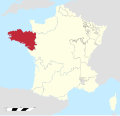
 Historic Brittany location.png 200 × 189; 20 KB
-
 Incursions vikings en Bretagne-es.svg 1,112 × 916; 456 KB
-
 Incursions vikings en Bretagne-fr.svg 1,112 × 916; 238 KB
-
 Kartenn bevenn ar brezhoneg.svg 1,064 × 794; 4.06 MB
-
 Ks Bretanii 1447.jpg 1,988 × 2,145; 721 KB
-
 L'émigration bretonne en Armorique.jpg 888 × 1,160; 249 KB
-
 Lanmeur Guimaëc Locquirec.jpg 388 × 410; 185 KB
-
 Location map of the Pays de la Loire region, France.svg 1,546 × 1,497; 906 KB
-
 Map Kingdom of Brittany 845-867-br.svg 700 × 600; 40 KB
-
 Map Kingdom of Brittany 845-867-de.svg 736 × 624; 250 KB
-
 Map Kingdom of Brittany 845-867-es.svg 700 × 600; 179 KB
-
 Map Kingdom of Brittany 845-867-fr.svg 700 × 600; 39 KB
-
 Map Kingdom of Brittany 845-867-hu.svg 700 × 600; 41 KB
-
 Map Kingdom of Brittany 845-867-pt.svg 700 × 600; 41 KB
-
 Map Kingdom of Brittany 845-867-ru.svg 700 × 600; 57 KB
-

-
 Map of the Clisson and Bellville estates in Brittany and France.jpg 1,261 × 746; 136 KB
-
 Marches Bretagne Poitou-fr.svg 1,361 × 917; 107 KB
-
 Marzioù Breizh Poatev.svg 1,361 × 917; 99 KB
-
 Parlement de Bretagne.svg 2,000 × 1,922; 897 KB
-
 Pays de Retz.jpg 222 × 171; 10 KB
-
 PSM V51 D039 Stature distribution of lower brittany.png 1,958 × 1,375; 1.2 MB
-
 PSM V51 D316 Stature in lower brittany.png 1,942 × 1,388; 987 KB
-
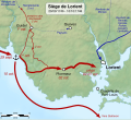 Raid on Lorient 1746 map-fr.svg 1,190 × 1,084; 854 KB
-
 Rannyezhoù brezhonek-br.svg 437 × 317; 121 KB
-
 Rouantelezhioù breizh.jpg 1,019 × 631; 204 KB
-
 Région judiciaire de Bretagne.gif 1,151 × 1,111; 33 KB
-
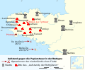 Révolte du papier timbré.svg 1,112 × 916; 257 KB
-
 Toponymes bretons map-fr.svg 1,064 × 794; 3.01 MB
-
 Variantes linguistiques du breton map-fr.svg 1,064 × 994; 1.67 MB
-
 Viking Incursions and Battles in Brittany.jpg 959 × 787; 177 KB
-
 Western Europe 5th Century ang.svg 700 × 575; 2.3 MB
-
 Western Europe 5th Century en.svg 700 × 575; 2.3 MB
-
 Western Europe 5th Century es.svg 700 × 575; 2.3 MB
-
 Western Europe 5th Century pt.svg 700 × 575; 2.3 MB


.svg)


.jpg)


