Category:Maps of the history of Brunei
Jump to navigation
Jump to search
Use the appropriate category for maps showing all or a large part of Brunei. See subcategories for smaller areas:
| If the map shows | Category to use |
|---|---|
| Brunei on a recently created map | Category:Maps of Brunei or its subcategories |
| Brunei on a map created more than 70 years ago | Category:Old maps of Brunei or its subcategories |
| the history of Brunei on a recently created map | Category:Maps of the history of Brunei or its subcategories |
| the history of Brunei on a map created more than 70 years ago | Category:Old maps of the history of Brunei or its subcategories |
Media in category "Maps of the history of Brunei"
The following 32 files are in this category, out of 32 total.
-
 Brunei Empire Extent 15th century.svg 1,000 × 500; 1,005 KB
-
 Brunei territorial lose (1400–1890).gif 450 × 225; 215 KB
-
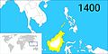 Brunei territories (1400).jpg 1,920 × 960; 398 KB
-
 Brunei territories (1400).png 1,920 × 960; 282 KB
-
 Brunei territories (1500).jpg 1,920 × 960; 400 KB
-
 Brunei territories (1500).png 1,920 × 960; 284 KB
-
 Brunei territories (1740).jpg 1,920 × 960; 393 KB
-
 Brunei territories (1740).png 1,920 × 960; 283 KB
-
 Brunei territories (1749).jpg 1,920 × 960; 395 KB
-
 Brunei territories (1749).png 1,920 × 960; 283 KB
-
 Brunei territories (1800).jpg 1,920 × 960; 402 KB
-
 Brunei territories (1800).png 1,920 × 960; 289 KB
-
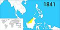 Brunei territories (1841).jpg 1,920 × 960; 395 KB
-
 Brunei territories (1841).png 1,920 × 960; 286 KB
-
 Brunei territories (1846).jpg 1,920 × 960; 400 KB
-
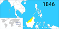 Brunei territories (1846).png 1,920 × 960; 290 KB
-
 Brunei territories (1853).jpg 1,920 × 960; 402 KB
-
 Brunei territories (1853).png 1,920 × 960; 291 KB
-
 Brunei territories (1861).jpg 1,920 × 960; 395 KB
-
 Brunei territories (1861).png 1,920 × 960; 284 KB
-
 Brunei territories (1865).jpg 1,920 × 960; 399 KB
-
 Brunei territories (1865).png 1,920 × 960; 286 KB
-
 Brunei territories (1884).jpg 1,920 × 960; 398 KB
-
 Brunei territories (1884).png 1,920 × 960; 281 KB
-
 Brunei territories (1888).jpg 1,920 × 960; 402 KB
-
 Brunei territories (1888).png 1,920 × 960; 279 KB
-
 Brunei territories (1890).jpg 1,920 × 960; 397 KB
-
 Brunei territories (1890).png 1,920 × 960; 284 KB
-
 LocationNorthBorneoFederation.PNG 250 × 115; 5 KB
-
 Southeast Asia trade route map XIIcentury.jpg 1,696 × 1,440; 521 KB
-
 Srivijayan Expansion.gif 362 × 369; 568 KB
-
 SrivijayaUKR.png 3,036 × 2,118; 176 KB

.gif)
.jpg)
.png)
.jpg)
.png)
.jpg)
.png)
.jpg)
.png)
.jpg)
.png)
.jpg)
.png)
.jpg)
.png)
.jpg)
.png)
.jpg)
.png)
.jpg)
.png)
.jpg)
.png)
.jpg)
.png)
.jpg)
.png)


