Category:Maps of the history of Yemen
Jump to navigation
Jump to search
Subcategories
This category has the following 16 subcategories, out of 16 total.
A
- Maps of Aden Protectorate (17 F)
- Maps of Colony of Aden (14 F)
C
F
H
- Maps of the Himyarite Kingdom (28 F)
M
N
- Maps of North Yemen (23 F)
O
- Maps of the Omani Empire (12 F)
P
S
U
Media in category "Maps of the history of Yemen"
The following 77 files are in this category, out of 77 total.
-
 01 Southern Arabia Map.tif 2,953 × 2,142; 6.05 MB
-
 1930s Nahd and South Yemen.png 811 × 520; 71 KB
-
 Aden Colony dependencies.png 515 × 507; 143 KB
-
 Kuzey yemen ic savasi 1967.png 800 × 1,085; 248 KB
-
 1972年北葉門南葉門邊界衝突.png 2,560 × 1,544; 352 KB
-
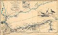 Aden gulf 1860.jpg 3,417 × 2,081; 1.34 MB
-
 Aden in Yemen (1990-2004).svg 1,524 × 995; 343 KB
-
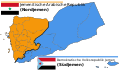
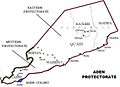 Aden Protectorate (British).jpg 740 × 537; 86 KB
-
 Aden Yemen on the globe (South Yemen centered orthographic projection).svg 845 × 845; 3.01 MB
-
 Al Ayed Emirate of Asir-ar.jpg 640 × 658; 107 KB
-
 Al Ayed Emirate of Asir.jpg 640 × 658; 66 KB
-
 Ancient Yemeni kingdom of saba.jpg 1,080 × 1,182; 112 KB
-
 Areas controlled by the Houthi government.jpg 4,096 × 2,770; 668 KB
-
 Beihan.jpg 800 × 508; 86 KB
-
 Caliph Abu Bakr's empire at its peak2-mohammad adil rais.PNG 1,196 × 580; 44 KB
-
 Carte Cheik-Said.jpg 1,041 × 639; 294 KB
-
 Darawiish state.png 550 × 447; 142 KB
-
 Divided Yemen (ru).svg 1,210 × 730; 44 KB
-
 Divided Yemen ar.svg 1,210 × 730; 44 KB
-
 Divided Yemen da.svg 1,210 × 730; 44 KB
-
 Divided Yemen de.svg 1,210 × 730; 44 KB
-
 Divided Yemen es.svg 1,210 × 730; 44 KB
-
 Divided Yemen fr.svg 1,210 × 730; 44 KB
-
 Divided Yemen pt.svg 1,210 × 730; 44 KB
-
 Divided Yemen uk.svg 1,210 × 730; 45 KB
-
 Divided Yemen zh.svg 1,210 × 730; 44 KB
-
 Divided Yemen-ko.svg 1,210 × 730; 44 KB
-
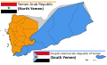 Divided Yemen.svg 1,210 × 730; 71 KB
-
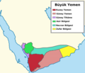 Greater yemen.png 1,027 × 880; 154 KB
-
 Hadramaut in Yemen (2004-2013).svg 1,524 × 995; 343 KB
-
 Halbinsel und Hafen von Aden.jpg 1,259 × 900; 204 KB
-
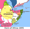 Horn of Africa 1895.png 426 × 415; 119 KB
-
 Horn of Africa and Southwest Arabia - Mid-1930s.jpg 503 × 525; 72 KB
-
 Houthis-control 2014-2015.gif 862 × 491; 275 KB
-
 Houthis-control-2014-2015-arabic.gif 862 × 491; 274 KB
-
 Insurgency Yemen map.png 1,200 × 783; 159 KB
-
 Kholan tribe.png 750 × 936; 118 KB
-
 Kolonie Aden.PNG 413 × 208; 8 KB
-
 Lahej Sultanate in its region1.png 574 × 317; 53 KB
-
 Lahej Sultanate in its region1.svg 574 × 317; 4.23 MB
-
 Lahej sultanate map with labels.svg 640 × 427; 409 KB
-
 Lahej sultanate map with labels2.png 640 × 427; 47 KB
-
 Lahej sultanate map with labels2.svg 640 × 427; 412 KB
-
 Lahej sultanate map.svg 640 × 427; 407 KB
-
 Lahej.jpg 800 × 508; 52 KB
-
 MahraSultanate.png 1,292 × 1,052; 72 KB
-
 Map of the MENA region in 1798.svg 1,543 × 1,006; 528 KB
-
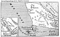
 Map of the Sheikhdoms of al-Hawra and al-ʽIrqa in 1926.png 915 × 730; 650 KB
-
 Mutawakkilite Kingdom of Yemen map.svg 574 × 317; 4.33 MB
-
 Protectorate of South Arabia in its region.svg 574 × 317; 6.96 MB
-
 Rasulid 1264.jpg 1,660 × 1,100; 1.15 MB
-
 Regions of Yemen map AR.svg 1,210 × 730; 112 KB
-
 Regions of Yemen map-es.svg 1,210 × 730; 92 KB
-
 Regions of Yemen map.svg 1,210 × 730; 68 KB
-
 State of Mahra in its region (1923).svg 1,162 × 1,225; 1.57 MB
-
 State of Mahra in the Arabian Peninsula map (1923).svg 1,162 × 1,225; 1.57 MB
-
 Tahiride Dynasty yemen.jpg 1,132 × 847; 94 KB
-
 The Kingdom of Aksum.png 17,877 × 20,000; 4.2 MB
-
 Upper Yafa in its region.png 574 × 317; 52 KB
-
 Upper Yafa in its region.svg 574 × 317; 4.23 MB
-
 Violet line.png 800 × 464; 68 KB
-
 Ye mapsa.gif 1,673 × 910; 55 KB
-
 Ye mapha.GIF 943 × 567; 14 KB
-
 Yemen 1160 AD.jpg 1,660 × 1,100; 1,018 KB
-
 Yemen AQAP emirate.png 1,024 × 669; 62 KB
-
 Yemen civil war detailed map.png 1,668 × 1,034; 217 KB
-
 Yemen Diaspora.png 1,425 × 625; 42 KB
-
 Yemen Himyarite 330 AD.jpg 1,660 × 1,100; 1.29 MB
-
 Yemen Pt06-ar.jpg 1,693 × 1,106; 563 KB
-
 Yemen Pt06.jpg 1,693 × 1,106; 448 KB
-
 Yemen Pt08.jpg 1,693 × 1,106; 441 KB
-
 Yemen Topography.png 1,636 × 1,178; 1.7 MB
-
 Yemen-Saudi War.gif 518 × 518; 290 KB
-
 Yemencivilwar.png 1,200 × 972; 303 KB
-
 Zaydi State 1675.jpg 1,660 × 1,100; 1.25 MB
-
 السلطنة الأيوبية.jpg 589 × 427; 87 KB
-
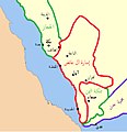
 خريطة سلاطين القبائل في اليمن الجنوبي و جنوب اليمن.jpg 800 × 584; 118 KB


.svg)
.jpg)
.svg)


.svg)


.svg)


.svg)
.svg)


