Category:Maps of the history of East Timor
Jump to navigation
Jump to search
Subcategories
This category has the following 2 subcategories, out of 2 total.
2
O
Media in category "Maps of the history of East Timor"
The following 23 files are in this category, out of 23 total.
-
 East Timor districts blank 2002-2003.png 2,000 × 866; 15 KB
-
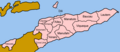 East Timor districts named 2002-2003.png 1,000 × 433; 18 KB
-
 East Timor districts numbered 2002-2003.png 500 × 217; 10 KB
-
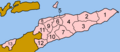
 East Timor municipalities.png 1,281 × 878; 23 KB
-
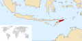
 Indonesia map of Timor.png 584 × 404; 14 KB
-
 LocationEastTimor-Pre1911.svg 997 × 497; 2.3 MB
-
 Osttimor 1942-43.png 1,500 × 1,055; 351 KB
-
 Population Displacements 2007 East Timor.png 2,892 × 2,700; 1.85 MB
-
 Port-KlSunda.png 243 × 220; 12 KB
-
 Port-Timor WKII-v2.png 1,501 × 900; 238 KB
-
 Port-Timor WKII.png 1,501 × 900; 174 KB
-
 Port-Timor WWII-de.png 1,501 × 900; 271 KB
-
 Province of East Timor in Indonesia (1976–1999).svg 1,200 × 460; 921 KB
-
 Timor - Indonesian Invasion de2018.png 3,088 × 1,852; 654 KB
-
 Timor - Indonesian Invasion.png 3,088 × 1,852; 669 KB
-
 Timor 1700.png 2,000 × 1,683; 299 KB
-
 Timor hunger 2007.png 1,500 × 890; 314 KB
-
 Timor revolution1.png 3,128 × 1,856; 560 KB
-
 Timor revolution2.png 3,128 × 1,856; 349 KB
-
 Timor revolution3.png 3,128 × 1,856; 422 KB
-
 Timor1986.png 2,560 × 1,580; 341 KB
-
 TL Widerstandssektoren 1975-1999.png 1,024 × 702; 73 KB
-
 Westtimor 1911.png 2,296 × 1,796; 1.19 MB


.svg)