Category:Maps of the ancient Near East
Jump to navigation
Jump to search
Maps of the ancient Near East.
Use the appropriate category for maps showing all or a large part of the ancient Near East. See subcategories for smaller areas:
| If the map shows | Category to use |
|---|---|
| the ancient Near East on a recently created map | Category:Maps of the ancient Near East or its subcategories |
| the ancient Near East on a map created more than 70 years ago | Category:Old maps of the ancient Near East or its subcategories |
| the history of the ancient Near East on a recently created map | Category:Maps of the history of the ancient Near East or its subcategories |
| the history of the ancient Near East on a map created more than 70 years ago | Category:Old maps of the history of the ancient Near East or its subcategories |
Wikimedia category | |||||
| Upload media | |||||
| Instance of | |||||
|---|---|---|---|---|---|
| |||||
Subcategories
This category has the following 24 subcategories, out of 24 total.
!
A
- Amurru (11 F)
B
C
- Maps of Carchemish (3 F)
- Maps of Commagene (53 F)
- Maps of Corduene (49 F)
E
- Maps of Elam (87 F)
L
M
- Maps of Adiabene (10 F)
- Maps of Mitanni (36 F)
O
- Maps of Osrhoene (63 F)
P
- Ptolemy's 3rd African Map (53 F)
S
- Maps of Sophene (46 F)
Media in category "Maps of the ancient Near East"
The following 70 files are in this category, out of 70 total.
-
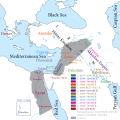
14 century BC Eastern ca.svg 1,001 × 557; 92 KB
-
14 century BC Eastern Mediterranean and the Middle East.png 1,041 × 578; 579 KB
-
14 century BC Eastern-ar.svg 1,001 × 557; 883 KB
-
14 century BC Eastern-es.svg 1,001 × 557; 367 KB
-
14 century BC Eastern-pt.svg 1,001 × 557; 377 KB
-
14 century BC Eastern.El.png 1,034 × 574; 566 KB
-
Alter Orient.PNG 1,357 × 628; 18 KB
-
AlterOrient.jpg 1,400 × 940; 454 KB
-
Amarnamap.png 782 × 607; 743 KB
-
Ancient colonies-ar.png 2,500 × 1,249; 982 KB
-
Ancient colonies.PNG 2,500 × 1,249; 761 KB
-
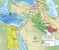
Ancient Egypt and Mesopotamia c. 1450 BC.png 1,200 × 1,473; 259 KB
-
Ancient Empires (Europe and Middle East).jpg 1,095 × 1,550; 278 KB
-
Ancient Middle East Civilizations Outline Map (Anat) (EN) (FONT) (V2) (REV0).svg 3,800 × 3,800; 130 KB
-
Ancient Middle East Civilizations Outline Map (Anat) (EN) (PATH) (V2) (REV0).svg 3,800 × 3,800; 562 KB
-
Ancient Middle East Civilizations Outline Map (Anat) (PL) (FONT) (V2) (REV0).svg 3,800 × 3,800; 130 KB
-
Ancient Middle East Civilizations Outline Map (Anat) (PL) (PATH) (V2) (REV0).svg 3,800 × 3,800; 584 KB
-
Ancient Orient.png 4,365 × 2,816; 10.18 MB
-
Archaeology of the Ancient Near East.png 705 × 567; 28 KB
-
AreasOfHabiruActivityInAmarnaLetters-pl.svg 1,500 × 1,000; 664 KB
-
AreasOfHabiruActivityInAmarnaLetters-ru.svg 1,500 × 1,000; 641 KB
-
AreasOfHabiruActivityInAmarnaLettersLBIIA.svg 1,500 × 1,000; 620 KB
-
Buddhism Growth in Hellenic World.png 20,000 × 11,624; 11.45 MB
-
Cadusia.jpg 975 × 518; 93 KB
-
Corduene-Korchek-rus.png 2,460 × 1,990; 163 KB
-
Culture of Antiquity.png 2,282 × 1,552; 1.28 MB
-
Fertile Crescent blank base map.png 1,200 × 1,473; 279 KB
-
Gurgum 12 század.jpg 944 × 665; 159 KB
-
Harta 8 Migraţia lui Avraam din Ur în Canaan.3D digital art.png 1,049 × 809; 2.05 MB
-
II үйэтээҕи Рим империятыгар баар христианстволар көрүҥнэрин каарталара.png 1,813 × 982; 861 KB
-
Karte Seleucia Ktesiphon.png 849 × 1,200; 280 KB
-
Levant close.PNG 1,049 × 725; 272 KB
-
Levant midden waterwegen.JPG 2,666 × 2,895; 1.2 MB
-
Levant Situeringskaart.JPG 2,691 × 3,089; 1.27 MB
-
Ludy Morza (Sea Peoples).jpg 3,273 × 2,024; 705 KB
-
Map Amarna.png 583 × 599; 99 KB
-
Map of Babylonia and Elam.png 555 × 480; 322 KB
-
Map of the Levantine sites with El Khiam points.jpg 2,061 × 1,652; 1.98 MB
-
Mapa Mezopotámie.png 2,440 × 1,480; 1.42 MB
-
Mesopotamië.jpg 600 × 542; 87 KB
-
Moyen Orient 13e siècle.png 1,885 × 1,354; 2.87 MB
-
Moyen Orient 1600 aC.png 1,715 × 1,187; 2.56 MB
-
Moyen Orient Amarna 1.png 1,885 × 1,354; 2.87 MB
-
MÖ 3. Binyıl Mezopotamya.svg 1,426 × 1,083; 10.03 MB
-
NE 1300bc.jpg 1,285 × 1,008; 405 KB
-
Near East 1400 BCE es.svg 785 × 628; 343 KB
-
Near East 1400 BCE-ar.png 785 × 628; 121 KB
-
Near East 1400 BCE-he.png 785 × 628; 121 KB
-
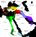
Near East 1400 BCE.png 785 × 628; 146 KB
-
Near East in 1000bc (en).jpg 684 × 543; 80 KB
-
Near East in 1300bc (en).jpg 688 × 396; 57 KB
-
Near East topographic map with toponyms 3000bc-en.svg 1,426 × 1,083; 10.03 MB
-
Near East topographic map with toponyms 3000bc-pt.svg 1,426 × 1,083; 10.04 MB
-
Near East topographic map with toponyms 3000bc.svg 1,426 × 1,083; 10.04 MB
-
Neo Assyrian Empire 671 B.C.gif 707 × 466; 18 KB
-
Obsidian trade (IV millennium BC).png 467 × 452; 67 KB
-
Orientmitja2500aC.png 674 × 420; 44 KB
-
PeuplesMerEgytiensHittites.jpg 1,510 × 1,132; 187 KB
-
Predynastique.JPG 1,381 × 882; 678 KB
-
Roma in Oriente 127aC.png 2,425 × 1,581; 3.3 MB
-
Second Mariote kingdom.png 1,326 × 842; 1.29 MB
-
Siti neolitici del Vicino Oriente.jpg 4,425 × 2,900; 1.14 MB
-
Starověký-Blízký-východ.png 1,112 × 763; 607 KB
-
Starożytny Bliski Wschód I poł. II tysiąclecia p.n.e..jpg 7,679 × 6,497; 2.87 MB
-
Third Mari.png 1,324 × 1,020; 1.39 MB
-
Yamhad and Vassals.png 1,325 × 1,052; 1.43 MB
-
Ziggurats.png 803 × 676; 569 KB
-
アッシリア帝国の版図(前9~7世紀).png 1,983 × 1,363; 407 KB


