Category:Maps of ancient Egypt
Jump to navigation
Jump to search
Wikimedia category | |||||
| Upload media | |||||
| Instance of | |||||
|---|---|---|---|---|---|
| Category combines topics | |||||
| Ancient Egypt | |||||
Egyptian civilization from the 31st century BC to the 1st century BC | |||||
| Instance of |
| ||||
| Location |
| ||||
| Start time |
| ||||
| Inception |
| ||||
| End time |
| ||||
| Dissolved, abolished or demolished date | |||||
| Follows | |||||
 | |||||
Maps about en:Ancient Egypt
Subcategories
This category has the following 24 subcategories, out of 24 total.
*
-
- Lepsius-Projekt - maps (57 F)
A
- Maps of Akhetaten (17 F)
- Maps of ancient Alexandria (27 F)
C
M
N
O
P
- Ptolemy's 3rd African Map (53 F)
S
Media in category "Maps of ancient Egypt"
The following 40 files are in this category, out of 40 total.
-
An atlas of ancient Egypt (IA cu31924026363097).pdf 1,087 × 1,422, 70 pages; 2.19 MB
-
4th Dynasty of Egypt-03.png 1,848 × 3,356; 1.18 MB
-
Nomes of Ancient Egypt.png 267 × 592; 57 KB
-
Aegyptus antiqua - btv1b53171214z (1 of 2).jpg 6,339 × 4,684; 5.04 MB
-
Aegyptus antiqua divisa in nomos - auth. P. du Val - btv1b5964078h.jpg 2,648 × 2,096; 1,015 KB
-
Aegyptus antiqua divisa in nomos - authore P. Duval - btv1b59640773.jpg 6,512 × 4,832; 5.02 MB
-
Ancient Egypt main map.png 1,577 × 3,219; 555 KB
-
Ancient Egypt map-ar.png 1,577 × 3,219; 281 KB
-
Ancient Egypt map-el.png 1,100 × 2,245; 374 KB
-
Ancient Egypt map-hiero (ms).svg 1,580 × 3,224; 2.44 MB
-
Ancient Egypt map-la.png 1,660 × 3,249; 880 KB
-
Ancient Egypt.png 550 × 681; 106 KB
-
Ancient Egyptian old and middle kingdom.png 1,765 × 2,049; 588 KB
-
Antik Mısır haritası.png 1,577 × 3,219; 307 KB
-
Atlas Universel d'Histoire et de Géographie - Carte 7.jpg 1,579 × 1,280; 387 KB
-
Egypt ancient detail wadi hammamat.png 469 × 288; 50 KB
-
Egypt during the 4th Dynasty (Lower Egypt).png 1,300 × 856; 292 KB
-
Egypt during the 4th Dynasty (Middle Egypt).png 1,300 × 1,247; 336 KB
-
Egypt during the 4th Dynasty (Upper Egypt).png 1,300 × 1,656; 380 KB
-
Egypt-Babylon-Quramati.jpg 882 × 820; 103 KB
-
Egypt-Map-ancient.svg 576 × 651; 266 KB
-
Gosen.jpg 266 × 479; 136 KB
-
Kaart Opper-Egypte.jpg 336 × 231; 18 KB
-
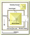
Khendjer complex.jpg 250 × 288; 15 KB
-
Language Maps Known Egyptian World 1.jpg 219 × 217; 25 KB
-
Language Maps Known Egyptian World.jpg 960 × 720; 98 KB
-
Map Ancient Egypt 1928-1940 - Touring Club Italiano CART-TRC-34.jpg 4,551 × 6,298; 2.78 MB
-
Mapo de antikva Egiptio - centro.jpg 1,239 × 1,831; 313 KB
-
Mapo de antikva Egiptio.jpg 1,239 × 3,076; 430 KB
-
Meydum and Memphis (III) (1910) (14593492058).jpg 1,394 × 3,082; 183 KB
-
Muistne Egiptus.png 1,578 × 2,977; 426 KB
-
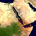
NC Punt.jpg 400 × 400; 77 KB
-
Near East 1400 BCE pt.svg 785 × 628; 346 KB
-
Nekhen Map.PNG 298 × 272; 24 KB
-
Upper Egypt Nomes.png 865 × 1,678; 208 KB
-
Ægyptus antiqua (NYPL b14212718-1267829).jpg 3,152 × 4,617; 3.42 MB
-
Positions-sites-époque-archaïque-égypte.jpg 2,310 × 3,302; 422 KB
-
Sheshi scarabs locations.png 1,578 × 2,783; 338 KB
-
Archeologia biblijna T. 1 1899 (47318455).jpg 1,301 × 2,008; 1.24 MB
-
المملكة المصرية القديمة.png 353 × 524; 73 KB


