Category:Maps of Corduene
Jump to navigation
Jump to search
Wikimedia category | |||||
| Upload media | |||||
| Instance of | |||||
|---|---|---|---|---|---|
| Category combines topics | |||||
| Corduene | |||||
historical province of Greater Armenia | |||||
| Instance of |
| ||||
| Location |
| ||||
 | |||||
Media in category "Maps of Corduene"
The following 49 files are in this category, out of 49 total.
-
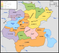
73artzrounis.png 700 × 653; 53 KB
-
Armenia Minor map first century BC.jpg 625 × 471; 204 KB
-
Arshakuni Armenia 150-ca.svg 2,717 × 1,595; 832 KB
-
Arshakuni Armenia 150-en.svg 2,717 × 1,595; 875 KB
-
Arshakuni Armenia 150-es.svg 2,898 × 1,701; 3.49 MB
-
Arshakuni Armenia 150-fr.svg 2,717 × 1,595; 763 KB
-
Arshakuni Armenia 150-pt.svg 2,717 × 1,595; 1.03 MB
-
ArshakuniArmenia150.png 1,000 × 575; 43 KB
-
Artzrounis-pt.svg 677 × 612; 80 KB
-
C+B-Assyria-DetailedMap.JPG 1,897 × 1,350; 757 KB
-
Caucasus03333.jpg 778 × 600; 107 KB
-
Corduene-Korchek-rus.png 2,460 × 1,990; 163 KB
-
Map of Great Armenia, 1869.jpg 910 × 603; 156 KB
-
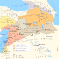
Map of the Armenian Empire of Tigranes (English).svg 512 × 506; 61 KB
-
Maps of the Armenian Empire of Tigranes-es.svg 1,975 × 1,958; 640 KB
-
Maps of the Armenian Empire of Tigranes-he.svg 512 × 506; 38 KB
-
Maps of the Armenian Empire of Tigranes-pt.svg 512 × 506; 50 KB
-
Maps of the Armenian Empire of Tigranes.gif 673 × 669; 56 KB
-
Near East ancient map.jpg 638 × 415; 377 KB
-
Putzger Kleinasien Zuschnitt.jpg 3,804 × 2,835; 6.76 MB
-
Putzger Kleinasien.jpg 5,385 × 3,539; 11.89 MB
-
Roman East 50 CE Commagene highlighted-en.svg 2,717 × 1,595; 854 KB
-
Roman East 50 CE Commagene highlighted-zh.svg 3,396 × 1,993; 2.7 MB
-
Roman East 50-ang.svg 2,717 × 1,595; 822 KB
-
Roman East 50-en.svg 2,717 × 1,595; 848 KB
-
Roman East 50-es.svg 2,717 × 1,595; 3.6 MB
-
Roman East 50-fi.svg 2,717 × 1,595; 854 KB
-
Roman East 50-he.svg 2,717 × 1,595; 854 KB
-
Roman East 50-hu.svg 2,717 × 1,595; 858 KB
-
Roman East 50-hy.svg 2,717 × 1,595; 853 KB
-
Roman East 50-it.svg 2,717 × 1,595; 857 KB
-
Roman East 50-pt.svg 2,717 × 1,595; 851 KB
-
Roman East 50-zh.svg 3,396 × 1,993; 2.68 MB
-
Roman provinces of Asia Minor.jpg 4,304 × 2,827; 3.55 MB
-
Roman-Persian Frontier in Late Antiquity-ar.svg 2,727 × 1,804; 1.72 MB
-
Roman-Persian Frontier in Late Antiquity-es.svg 2,727 × 1,804; 4.55 MB
-
Roman-Persian Frontier in Late Antiquity-fr.svg 2,727 × 1,804; 849 KB
-
Roman-Persian Frontier in Late Antiquity-hu.svg 2,727 × 1,804; 3.2 MB
-
Roman-Persian Frontier in Late Antiquity-pt.svg 2,727 × 1,804; 830 KB
-
Roman-Persian Frontier in Late Antiquity-ru.svg 2,718 × 1,743; 1.61 MB
-
Roman-Persian Frontier in Late Antiquity-zh.svg 2,710 × 1,740; 1.58 MB
-
Roman-Persian Frontier in Late Antiquity.svg 2,710 × 1,740; 2 MB
-
Transcaucasia 2nd BC-ar.png 982 × 772; 445 KB
-
Transcaucasia 2nd BC.jpg 982 × 772; 232 KB
-
Yervanduni Armenia, IV-II BC.gif 700 × 457; 58 KB
-
Карта Малой Азии.png 8,500 × 4,137; 3.76 MB
-
Կորճայք.png 1,490 × 856; 78 KB
-
Հայաստանը վաղ միջնադարում.svg 2,710 × 1,740; 830 KB


