Category:Topographic maps of the Pyrenees
Jump to navigation
Jump to search
Subcategories
This category has the following 11 subcategories, out of 11 total.
*
A
C
N
Media in category "Topographic maps of the Pyrenees"
The following 25 files are in this category, out of 25 total.
-
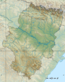
 Adour basin.png 395 × 401; 326 KB
-
 Arbailles OpenTopoMap altitudes couleurs.jpg 3,507 × 2,480; 2.12 MB
-
 Arbailles OpenTopoMap.jpg 3,507 × 2,480; 2.19 MB
-
 Carte des Lacs de la zone Néouvielle - Hautes Pyrénées.jpg 836 × 616; 288 KB
-
 Hydrographie et failles actives des Pyrénées.png 850 × 414; 227 KB
-
 Languedoc-Roussillon-Midi-Pyrénées region relief location map.jpg 1,628 × 1,261; 1.02 MB
-
 Le Midi.png 920 × 598; 740 KB
-
 Midi pyrenees topographic blank map.jpg 594 × 549; 203 KB
-
 Position Ossau.png 820 × 579; 716 KB
-
 Pyrenees topographic map-de.svg 3,200 × 1,900; 6.3 MB
-
 Pyrenees topographic map-eo.svg 3,200 × 1,900; 6.01 MB
-
 Pyrenees topographic map-es.svg 3,200 × 1,900; 6.15 MB
-
 Pyrenees relief map with rivers-fr.svg 3,200 × 1,900; 2.41 MB
-
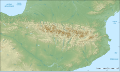
 Pyrenees Relief.png 1,266 × 786; 2.05 MB
-
 Pyrenees topo map-blank.jpg 4,787 × 2,842; 4.82 MB
-
 Pyrenees topographic map-ca.svg 3,200 × 1,900; 6.27 MB
-
 Pyrenees topographic map-en.svg 3,200 × 1,900; 6.3 MB
-
 Pyrenees topographic map-fr.svg 3,200 × 1,900; 6.3 MB
-
 Pyrenees topographic map-it.svg 3,200 × 1,900; 6.3 MB
-
 Pyrenees topographic map-mk.svg 3,200 × 1,900; 7.54 MB
-
 Pyrenees topographic map-pl.svg 3,200 × 1,900; 6.31 MB
-
 Pyrenees topographic map-ru.svg 3,200 × 1,900; 6.3 MB
-
 Pyrenees topographic map.png 1,264 × 796; 2.08 MB
-
 Spain Aragón location map relief.png 1,705 × 2,154; 3.78 MB
-
 Tableau orographique... de la chaîne des Pyrénées - Frossard, Emilien - btv1b105677251.jpg 9,024 × 3,798; 3.59 MB


