Category:Maps of rivers of China
Jump to navigation
Jump to search
Subcategories
This category has the following 9 subcategories, out of 9 total.
I
- Maps of the Irtysh River (14 F)
M
- Maps of Amur River (40 F)
- Maps of the Mekong (55 F)
- Maps of Min River (4 F)
P
S
- Maps of the Salween River (44 F)
Y
Media in category "Maps of rivers of China"
The following 28 files are in this category, out of 28 total.
-
 Bridges over the Nandu River - 2015.png 805 × 653; 23 KB
-
 Carte-des-bassins-versants-de-la-Chine.jpg 2,800 × 1,869; 1.63 MB
-
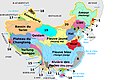
 China rivers.svg 1,084 × 907; 333 KB
-
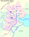 Hai River Basin EN.svg 715 × 883; 66 KB
-
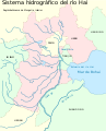 Hai River Basin ES.svg 715 × 883; 49 KB
-
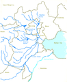
 Hai River Basin ZH.svg 715 × 883; 44 KB
-
 HaiheBasinEn.png 500 × 613; 110 KB
-
 Hainan - Haikou - Nandu rivermap.png 852 × 667; 286 KB
-
 HeiHe basin.png 3,506 × 2,481; 478 KB
-
 Huairivermap.jpg 721 × 462; 220 KB
-
 Jinsharivermap.jpg 434 × 383; 166 KB
-
 Location Mudanjiang-River.png 760 × 632; 357 KB
-
 Location Tumen-River.png 489 × 337; 111 KB
-
 Location Ussuri-River.png 664 × 441; 335 KB
-
 LocationNen.png 612 × 417; 420 KB
-
 LocationSonghua.PNG 612 × 417; 222 KB
-
 Luanhe.png 800 × 800; 265 KB
-
 Luanhe2.png 800 × 800; 257 KB
-
 Map of the South–North Water Transfer Project in China (blank).png 2,340 × 1,199; 362 KB
-
 Map of the South–North Water Transfer Project in China (de).png 2,340 × 1,199; 646 KB
-
 Narrative of a Voyage around the World - Map of Canton River.jpg 2,495 × 2,434; 377 KB
-
 PSM V72 D230 Map of waterways near hangzhou 1906.png 1,558 × 993; 373 KB
-
 Rivers in China.svg 1,000 × 746; 1.93 MB
-
 Rivers of China with Historical Names.jpg 4,980 × 3,920; 1.27 MB
-
 Shenzen reservoir watershed.jpg 1,394 × 849; 380 KB
-
 Shulerivermap.jpg 827 × 496; 288 KB
-
 Stream gauges HeiHe.png 2,411 × 2,472; 310 KB
-
 Yarlung Tsangpo map.png 1,706 × 1,111; 1.58 MB


.png)
.png)