
Category:Maps of the Yellow River
Media in category "Maps of the Yellow River"
The following 87 files are in this category, out of 87 total.
-
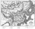
 "Xantung, Sinarum Imperii provincia quarta." (21632336863).jpg 3,691 × 3,025; 2.09 MB
-
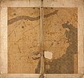 Da Ming yu di tu LOC 2002626776-1.jpg 9,658 × 9,049; 11.2 MB
-
 Da Ming yu di tu LOC 2002626776-1.tif 9,658 × 9,049; 250.04 MB
-
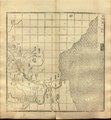
 Guang yu tu - er juan LOC 2008623187-1.jpg 4,380 × 4,658; 4.68 MB
-
 Guang yu tu - er juan LOC 2008623187-1.tif 4,380 × 4,658; 58.37 MB
-
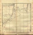
 Guang yu tu - er juan LOC 2008623187-32.jpg 4,320 × 4,658; 4.47 MB
-
 Guang yu tu - er juan LOC 2008623187-32.tif 4,320 × 4,658; 57.57 MB
-
 Guang yu tu - er juan LOC 2008623187-33.jpg 4,340 × 4,658; 4.15 MB
-
 Guang yu tu - er juan LOC 2008623187-33.tif 4,340 × 4,658; 57.84 MB
-
 Guang yu tu - er juan LOC 2008623187-34.jpg 4,360 × 4,658; 4.32 MB
-
 Guang yu tu - er juan LOC 2008623187-34.tif 4,360 × 4,658; 58.1 MB
-
 Guang yu tu - er juan LOC 2008623187-40.jpg 4,380 × 4,658; 3.94 MB
-
 Guang yu tu - er juan LOC 2008623187-40.tif 4,380 × 4,658; 58.37 MB
-
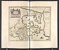
 AMH-6721-KB Map of China and Korea.jpg 2,400 × 2,187; 1,001 KB
-
 Xantvng - Atlas Maior, vol 11, map 16 - Joan Blaeu, 1667 - BL 114.h(star).11.(16).jpg 4,000 × 3,428; 1.94 MB
-
 Der Jesuiten-Atlas der Kanghsi-Zeit - China und die Aussenlaender LOC 74650033-16.jpg 6,288 × 6,072; 3.87 MB
-
 Der Jesuiten-Atlas der Kanghsi-Zeit - China und die Aussenlaender LOC 74650033-16.tif 6,288 × 6,072; 109.24 MB
-
 Der Jesuiten-Atlas der Kanghsi-Zeit - China und die Aussenlaender LOC 74650033-8.jpg 7,114 × 8,854; 6.89 MB
-
 Der Jesuiten-Atlas der Kanghsi-Zeit - China und die Aussenlaender LOC 74650033-8.tif 7,114 × 8,854; 180.21 MB
-
 Der Jesuiten-Atlas der Kanghsi-Zeit - China und die Aussenlaender LOC 74650033-9.jpg 9,514 × 9,444; 8.89 MB
-
 Der Jesuiten-Atlas der Kanghsi-Zeit - China und die Aussenlaender LOC 74650033-9.tif 9,514 × 9,444; 257.06 MB
-
 Routes du Kiang-Nan - btv1b52505950j (35 of 46).jpg 8,621 × 1,955; 1.65 MB
-
 Routes du Kiang-Nan - btv1b52505950j (37 of 46).jpg 6,963 × 1,918; 1.27 MB
-
 Liang Huai yan chang ji si sheng xing yan tu. LOC gm71005050.jpg 19,944 × 11,840; 21.3 MB
-
 Liang Huai yan chang ji si sheng xing yan tu. LOC gm71005050.tif 19,944 × 11,840; 675.59 MB
-
 Da Qing fen sheng yu tu LOC 2002626726-1.jpg 5,280 × 4,534; 2.43 MB
-
 Da Qing fen sheng yu tu LOC 2002626726-1.tif 5,280 × 4,534; 68.49 MB
-
 Mouth of the Yangtze 1754.jpg 1,247 × 860; 161 KB
-
 Zhi li ge sheng yu di quan tu - Zhang Zongjing - btv1b53103898v (17 of 69).jpg 5,102 × 4,405; 2.65 MB
-

-
 Henan quan tu LOC 96685909.jpg 10,907 × 11,397; 16.63 MB
-
 Henan quan tu LOC 96685909.tif 10,907 × 11,397; 355.65 MB
-

-

-

-

-

-
 Tian xia zong yu tu. LOC 2002626780-1.jpg 3,847 × 3,193; 1.35 MB
-
 Tian xia zong yu tu. LOC 2002626780-1.tif 3,847 × 3,193; 35.14 MB
-
 1912 China map from National Geographic.jpg 6,980 × 5,326; 10.65 MB
-
 1934年民生渠平面图.svg 512 × 255; 110 KB
-
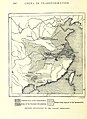
 310 of 'China in Transformation ... With ... maps and diagrams' (11291250283).jpg 1,287 × 1,142; 415 KB
-
 312 of 'China in Transformation ... With ... maps and diagrams' (11245748964).jpg 1,430 × 1,961; 839 KB
-

-
 Atlas Van der Hagen-KW1049B13 039-XANTVNG SINARVM IMPERII PROVICIA QUARTA.jpeg 5,500 × 4,523; 3.67 MB
-
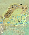
 Bassin-du-fleuve-jaune.png 2,239 × 1,183; 112 KB
-

-
 China Loess Plateau and Ordos Desert.png 2,160 × 1,100; 155 KB
-
 China Loess Plateau.png 2,160 × 1,100; 145 KB
-
 Evariste Huc carte voyage clear.png 903 × 734; 549 KB
-
 Evariste Huc carte voyage.jpg 3,559 × 2,794; 2.1 MB
-
 Evariste Huc carte voyage.png 903 × 734; 677 KB
-
 Fluvi Jaune - Topografia dau bacin.png 2,245 × 1,187; 440 KB
-
 Huang He nan he tu. LOC gm71005024.jpg 23,436 × 5,064; 15.35 MB
-
 Huang He nan he tu. LOC gm71005024.tif 23,436 × 5,064; 339.55 MB
-
 Huanghemap zh-hans.png 2,160 × 1,100; 152 KB
-
 Huanghemap zh-hant.png 2,160 × 1,100; 158 KB
-
 Huanghemap.png 2,160 × 1,100; 94 KB
-
 HuangHeZmenyDolnihoToku.PNG 665 × 440; 33 KB
-
 Major cities along the Yellow River.svg 680 × 320; 8 KB
-
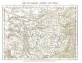 Map of Tartary, Thibet, and China.png 2,951 × 2,262; 6.01 MB
-

-

-

-

-
 Physical map of Tibet.png 833 × 490; 446 KB
-
 Shandong Sheng Huang He tu. LOC gm71005026.jpg 21,955 × 6,164; 12.17 MB
-
 Shandong Sheng Huang He tu. LOC gm71005026.tif 21,955 × 6,164; 387.18 MB
-
 Topografic map of Tibetan Plateau.png 1,365 × 732; 663 KB
-
 Xantung, sinarum imperii provincia quarta - (tiré du P. Martini) - btv1b5963044d.jpg 5,896 × 4,832; 4.73 MB
-
 Yangtze River and Yellow River.gif 2,185 × 1,790; 80 KB
-
 Yellow River (Indiana) watershed.jpg 1,444 × 1,001; 428 KB
-
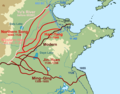
 Yellow River course changes.gif 583 × 452; 983 KB
-
 Yellow River watercourse change 1855.svg 341 × 274; 271 KB
-
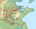
 Yellow River watercourse changes en.png 1,087 × 852; 251 KB
-
 Yellow River watercourse changes en.svg 512 × 410; 275 KB
-
 Yellow River watercourse changes.svg 341 × 274; 372 KB
-
 Yellow river.svg 680 × 320; 3 KB
-
 Yellowrivermap copy copy.jpg 410 × 494; 273 KB
-
 Yellowrivermap-2.jpg 1,100 × 544; 140 KB
-
 Yellowrivermap-fr.png 2,497 × 1,293; 994 KB
-
 Yellowrivermap-zh-hans.jpg 1,100 × 544; 554 KB
-
 Yellowrivermap-zh-hant.jpg 1,100 × 544; 554 KB
-
 Yellowrivermap.jpg 2,497 × 1,571; 1.19 MB
-
 土默特右旗河流灌渠图.svg 512 × 323; 311 KB
-
 民生渠平面略图1934年.svg 512 × 255; 84 KB
-
 黄河流域主要城市.svg 680 × 320; 9 KB
.jpg)


.11.(16).jpg)


.jpg)
.jpg)

.jpg)
.jpg)
.jpg)
.jpg)
.jpg)


.jpg)


.jpg)


_(cropped).jpg)
.jpg)

.jpg)


_-_btv1b5963044d.jpg)

_watershed.jpg)


.jpg)
.jpg)
.jpg)
.jpg)