Category:Maps of regions of the Netherlands
Appearance
English: Maps of regions in the Netherlands with no official administative status.
This is also a long list of maps of all regions of the Netherlands.
This is also a long list of maps of all regions of the Netherlands.
Subcategories
This category has the following 28 subcategories, out of 28 total.
*
A
- Maps of Achterhoek (29 F)
- Maps of Alblasserwaard (3 F)
B
G
- Maps of Gelderse Vallei (3 F)
H
I
- Maps of IJsselland (6 F)
K
L
- Maps of Liemers (9 F)
O
P
S
T
U
V
W
- Maps of West Friesland (27 F)
Z
Media in category "Maps of regions of the Netherlands"
The following 3 files are in this category, out of 3 total.
-
Benelux államok.png 460 × 643; 28 KB
-
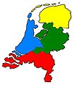
Nederlandgebieden1.JPG 317 × 363; 16 KB
-
Regions of Netherlands (alternate).png 1,684 × 1,200; 113 KB


