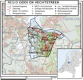
Category:Maps of Het Gooi
Appearance
Wikimedia category | |||||
| Upload media | |||||
| Instance of | |||||
|---|---|---|---|---|---|
| Category combines topics | |||||
| Gooi | |||||
region in the Netherlands | |||||
| Instance of | |||||
| Part of | |||||
| Location |
| ||||
| Different from | |||||
 | |||||
Media in category "Maps of Het Gooi"
The following 31 files are in this category, out of 31 total.
-
Het Gooi.jpg 620 × 559; 110 KB
-
1039 of 'Atlas, etc' (11166262713).jpg 1,520 × 2,280; 869 KB
-
2009-Risicokaart-Regio14-Gooi en Vechtstreek.jpg 478 × 467; 121 KB
-
2010-R14-Gooi Vechtstreek-basisbeeld.jpg 604 × 602; 210 KB
-
2012-R14-GV-basis.jpg 666 × 512; 284 KB
-
2013-R14-GV-b.jpg 787 × 605; 373 KB
-
Fragment van een kaart van Gooiland 17e eeuw. - Unknown - 20318008 - RCE.jpg 2,434 × 3,048; 3.23 MB
-
Fragment van kaart van Gooiland H.Post ca.1740 - Unknown - 20318005 - RCE.jpg 3,065 × 2,451; 4.27 MB
-
Gooiland - Ottens, 1725-47.JPG 3,496 × 2,247; 1.77 MB
-
Heidegebieden Gooi.JPG 808 × 540; 65 KB
-
Het Gooi kaart.xcf 2,560 × 1,365; 864 KB
-
Het Gooi kaart1.png 2,560 × 1,365; 406 KB
-
HetGooi.jpg 1,200 × 1,600; 1,019 KB
-
Kaart Gooi en Vechtstreek jan 2019.pdf 1,239 × 1,239; 2.79 MB
-
Kaart GooischeTram.PNG 532 × 338; 67 KB
-
Oud Naarden OSM.jpg 1,076 × 680; 159 KB
-
Regio-14-Gooi-2009.png 435 × 422; 120 KB
-
Wandelkaart door Gooiland verkend 1885 - Unknown - 20318011 - RCE.jpg 3,065 × 3,030; 1.81 MB
-
Wandelkaart door het Gooi-Eemland, Amsterdam 1875 - Unknown - 20318010 - RCE.jpg 3,047 × 3,036; 2.71 MB


