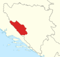
Category:Maps of regions of Bosnia and Herzegovina
Jump to navigation
Jump to search
Subcategories
This category has the following 4 subcategories, out of 4 total.
M
- Maps of Tropolje (6 F)
Media in category "Maps of regions of Bosnia and Herzegovina"
The following 25 files are in this category, out of 25 total.
-
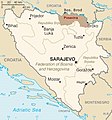
Bih regions01.png 1,103 × 1,044; 67 KB
-
Bih regions02.png 1,103 × 1,044; 66 KB
-
Bih regions03.png 1,103 × 1,044; 37 KB
-
Bih regions04.png 1,103 × 1,044; 56 KB
-
Bosanska Posavina.jpg 326 × 350; 42 KB
-
Bosna regija.jpg 330 × 355; 35 KB
-
Bosna region.png 1,312 × 1,240; 99 KB
-
Bosnia and Herzegovina Regions map(uk).png 1,995 × 2,517; 1.51 MB
-
Bosnia and Herzgovinia Regions.svg 429 × 425; 11 KB
-
Bosnia.regions.jpeg 431 × 416; 26 KB
-
Central bosnia and northern hercegovina.png 1,060 × 694; 276 KB
-
Dalmatia Croatia Slavonia Bosnia 1720 Matthaeus Seuteri.png 2,230 × 1,944; 150 KB
-
Drina Oberlauf.jpg 1,574 × 1,108; 271 KB
-
HistoricalRomanijainBosnia.jpg 1,869 × 918; 332 KB
-
Lijevče.jpg 628 × 599; 124 KB
-
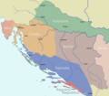
Map of Lika Northern Dalmatia and Western Bosnia.png 834 × 565; 521 KB
-
Neum strip location map.svg 1,097 × 673; 807 KB
-
Osat.jpg 628 × 599; 129 KB
-
Peljesac en Neum.png 483 × 237; 17 KB
-
Pelješac bridge location map.svg 1,097 × 673; 810 KB
-
Regije BiH mk.svg 1,600 × 1,520; 330 KB
-
Regije BiH.svg 1,600 × 1,520; 381 KB
-
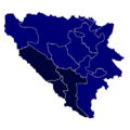
Regions of Bosnia and Herzegovina by HDI (2021).png 500 × 500; 120 KB
-
Tropolje map.png 2,000 × 1,908; 244 KB
-
Vitez region.png 1,058 × 674; 159 KB


