Category:Maps of municipalities in the district of Prättigau-Davos
Jump to navigation
Jump to search
Subcategories
This category has the following 6 subcategories, out of 6 total.
2
Media in category "Maps of municipalities in the district of Prättigau-Davos"
The following 12 files are in this category, out of 12 total.
-
 Karte Gemeinden der Region Prättigau-Davos 2021.png 1,476 × 1,419; 395 KB
-
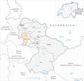
 Karte Gemeinde Conters im Prättigau 2021.png 1,476 × 1,419; 395 KB
-
 Karte Gemeinde Davos 2021.png 1,476 × 1,419; 397 KB
-
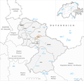
 Karte Gemeinde Fideris 2021.png 1,476 × 1,419; 395 KB
-
 Karte Gemeinde Furna 2021.png 1,476 × 1,419; 395 KB
-
 Karte Gemeinde Grüsch 2021.png 1,476 × 1,419; 395 KB
-
 Karte Gemeinde Jenaz 2021.png 1,476 × 1,419; 395 KB
-
 Karte Gemeinde Klosters 2021.png 1,476 × 1,419; 397 KB
-
 Karte Gemeinde Küblis 2021.png 1,476 × 1,419; 395 KB
-
 Karte Gemeinde Luzein 2021.png 1,476 × 1,419; 396 KB
-
 Karte Gemeinde Schiers 2021.png 1,476 × 1,419; 396 KB
-
 Karte Gemeinde Seewis im Prättigau 2021.png 1,476 × 1,419; 395 KB


