Category:Maps of municipalities in the district of Prättigau-Davos to 2008
Jump to navigation
Jump to search
Media in category "Maps of municipalities in the district of Prättigau-Davos to 2008"
The following 15 files are in this category, out of 15 total.
-
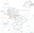
 Karte Gemeinde Conters im Prättigau 2007.png 1,181 × 1,135; 313 KB
-
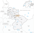
 Karte Gemeinde Davos 2007.png 1,181 × 1,135; 314 KB
-
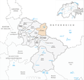
 Karte Gemeinde Fanas 2007.png 1,181 × 1,135; 313 KB
-
 Karte Gemeinde Fideris 2007.png 1,181 × 1,135; 313 KB
-
 Karte Gemeinde Furna 2007.png 1,181 × 1,135; 313 KB
-
 Karte Gemeinde Grüsch 2007.png 1,181 × 1,135; 313 KB
-
 Karte Gemeinde Jenaz 2007.png 1,181 × 1,135; 313 KB
-
 Karte Gemeinde Klosters-Serneus 2007.png 1,181 × 1,135; 315 KB
-
 Karte Gemeinde Küblis 2007.png 1,181 × 1,135; 313 KB
-
 Karte Gemeinde Luzein 2007.png 1,181 × 1,135; 313 KB
-
 Karte Gemeinde Saas im Prättigau 2007.png 1,181 × 1,135; 313 KB
-
 Karte Gemeinde Schiers 2007.png 1,181 × 1,135; 314 KB
-
 Karte Gemeinde Seewis im Prättigau 2007.png 1,181 × 1,135; 314 KB
-
 Karte Gemeinde St. Antönien 2007.png 1,181 × 1,135; 314 KB
-
 Karte Gemeinde Valzeina 2007.png 1,181 × 1,135; 313 KB


