Category:Maps of land use of communes in Tarn-et-Garonne
Jump to navigation
Jump to search
Departments of Metropolitan France: Ain [01] · Aisne [02] · Allier [03] · Alpes-de-Haute-Provence [04] · Hautes-Alpes [05] · Alpes-Maritimes [06] · Ardèche [07] · Ardennes [08] · Ariège [09] · Aube [10] · Aude [11] · Aveyron [12] · Bouches-du-Rhône [13] · Calvados [14] · Cantal [15] · Charente [16] · Charente-Maritime [17] · Cher [18] · Corrèze [19] · Corse-du-Sud [2A]† · Haute-Corse [2B]† · Côte-d’Or [21] · Côtes-d'Armor [22] · Creuse [23] · Dordogne [24] · Doubs [25] · Drôme [26] · Eure [27] · Eure-et-Loir [28] · Finistère [29] · Gard [30] · Haute-Garonne [31] · Gers [32] · Gironde [33] · Hérault [34] · Ille-et-Vilaine [35] · Indre [36] · Indre-et-Loire [37] · Isère [38] · Jura [39] · Landes [40] · Loir-et-Cher [41] · Loire [42] · Haute-Loire [43] · Loire-Atlantique [44] · Loiret [45] · Lot [46] · Lot-et-Garonne [47] · Lozère [48] · Maine-et-Loire [49] · Manche [50] · Marne [51] · Haute-Marne [52] · Mayenne [53] · Meurthe-et-Moselle [54] · Meuse [55] · Morbihan [56] · Moselle [57] · Nièvre [58] · Nord [59] · Oise [60] · Orne [61] · Pas-de-Calais [62] · Puy-de-Dôme [63] · Pyrénées-Atlantiques [64] · Hautes-Pyrénées [65] · Pyrénées-Orientales [66] · Bas-Rhin [67] · Haut-Rhin [68] · departmental district of the Rhône [69] · Rhône [69D]‡ · Metropolis of Lyon [69M]‡ · Haute-Saône [70] · Saône-et-Loire [71] · Sarthe [72] · Savoie [73] · Haute-Savoie [74] · Seine-Maritime [76] · Seine-et-Marne [77] · Yvelines [78] · Deux-Sèvres [79] · Somme [80] · Tarn [81] · Tarn-et-Garonne [82] · Var [83] · Vaucluse [84] · Vendée [85] · Vienne [86] · Haute-Vienne [87] · Vosges [88] · Yonne [89] · Territoire de Belfort [90] · Essonne [91] · Hauts-de-Seine [92] · Seine-Saint-Denis [93] · Val-de-Marne [94] · Val-d'Oise [95]
Media in category "Maps of land use of communes in Tarn-et-Garonne"
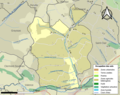
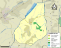
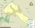
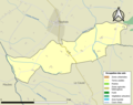
The following 195 files are in this category, out of 195 total.
-
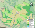
 82001-Albefeuille-Lagarde-Sols.png 3,270 × 2,598; 2.25 MB
-
 82002-Albias-Sols.png 3,270 × 2,598; 3.34 MB
-
 82003-Angeville-Sols.png 3,270 × 2,598; 1.78 MB
-
 82004-Asques-Sols.png 3,270 × 2,598; 2.12 MB
-
 82005-Aucamville-Sols.png 3,270 × 2,598; 2.29 MB
-
 82006-Auterive-Sols.png 3,270 × 2,598; 1.14 MB
-
 82007-Auty-Sols.png 3,270 × 2,598; 1.55 MB
-
 82008-Auvillar-Sols.png 3,270 × 2,598; 2.66 MB
-
 82009-Balignac-Sols.png 3,270 × 2,598; 1.12 MB
-
 82010-Bardigues-Sols.png 3,270 × 2,598; 1.72 MB
-
 82011-Barry-d'Islemade-Sols.png 3,270 × 2,598; 2.63 MB
-
 82012-Les Barthes-Sols.png 3,270 × 2,598; 2.64 MB
-
 82013-Beaumont-de-Lomagne-Sols.png 3,270 × 2,598; 3.61 MB
-
 82014-Beaupuy-Sols.png 3,270 × 2,598; 1.58 MB
-
 82015-Belbèze-en-Lomagne-Sols.png 3,270 × 2,598; 1.39 MB
-
 82016-Belvèze-Sols.png 3,270 × 2,598; 1.66 MB
-
 82017-Bessens-Sols.png 3,270 × 2,598; 1.99 MB
-
 82018-Bioule-Sols.png 3,270 × 2,598; 2.76 MB
-
 82019-Boudou-Sols.png 3,270 × 2,598; 1.95 MB
-
 82020-Bouillac-Sols.png 3,270 × 2,598; 2.45 MB
-
 82021-Bouloc-en-Quercy-Sols.png 3,270 × 2,598; 1.69 MB
-
 82022-Bourg-de-Visa-Sols.png 3,270 × 2,598; 1.78 MB
-
 82023-Bourret-Sols.png 3,270 × 2,598; 2.07 MB
-
 82024-Brassac-Sols.png 3,270 × 2,598; 2.38 MB
-
 82025-Bressols-Sols.png 3,270 × 2,598; 2.84 MB
-
 82026-Bruniquel-Sols.png 3,270 × 2,598; 2.96 MB
-
 82027-Campsas-Sols.png 3,270 × 2,598; 1.98 MB
-
 82028-Canals-Sols.png 3,270 × 2,598; 2.16 MB
-
 82029-Castanet-Sols.png 3,270 × 2,598; 1.85 MB
-
 82030-Castelferrus-Sols.png 3,270 × 2,598; 2.25 MB
-
 82031-Castelmayran-Sols.png 3,270 × 2,598; 3.58 MB
-
 82032-Castelsagrat-Sols.png 3,270 × 2,598; 2.58 MB
-
 82033-Castelsarrasin-Sols.png 3,270 × 2,598; 5.42 MB
-
 82034-Castéra-Bouzet-Sols.png 3,270 × 2,598; 1.78 MB
-
 82035-Caumont-Sols.png 3,270 × 2,598; 1.97 MB
-
 82036-Le Causé-Sols.png 3,270 × 2,598; 1.32 MB
-
 82037-Caussade-Sols.png 3,270 × 2,598; 4.48 MB
-
 82038-Caylus-Sols.png 3,270 × 2,598; 3.01 MB
-
 82039-Cayrac-Sols.png 3,270 × 2,598; 2.65 MB
-
 82040-Cayriech-Sols.png 3,270 × 2,598; 1.47 MB
-
 82041-Cazals-Sols.png 3,270 × 2,598; 1.1 MB
-
 82042-Cazes-Mondenard-Sols.png 3,270 × 2,598; 4.14 MB
-
 82043-Comberouger-Sols.png 3,270 × 2,598; 1.6 MB
-
 82044-Corbarieu-Sols.png 3,270 × 2,598; 3.01 MB
-
 82045-Cordes-Tolosannes-Sols.png 3,270 × 2,598; 2.65 MB
-
 82046-Coutures-Sols.png 3,270 × 2,598; 1.64 MB
-
 82047-Cumont-Sols.png 3,270 × 2,598; 1.81 MB
-
 82048-Dieupentale-Sols.png 3,270 × 2,598; 2.27 MB
-
 82049-Donzac-Sols.png 3,270 × 2,598; 3.12 MB
-
 82050-Dunes-Sols.png 3,270 × 2,598; 2.3 MB
-
 82051-Durfort-Lacapelette-Sols.png 3,270 × 2,598; 2.76 MB
-
 82052-Escatalens-Sols.png 3,270 × 2,598; 3.14 MB
-
 82053-Escazeaux-Sols.png 3,270 × 2,598; 1.93 MB
-
 82054-Espalais-Sols.png 3,270 × 2,598; 2.64 MB
-
 82055-Esparsac-Sols.png 3,270 × 2,598; 2 MB
-
 82056-Espinas-Sols.png 3,270 × 2,598; 2 MB
-
 82057-Fabas-Sols.png 3,270 × 2,598; 1.36 MB
-
 82058-Fajolles-Sols.png 3,270 × 2,598; 1.65 MB
-
 82059-Faudoas-Sols.png 3,270 × 2,598; 1.97 MB
-
 82060-Fauroux-Sols.png 3,270 × 2,598; 1.66 MB
-
 82061-Féneyrols-Sols.png 3,270 × 2,598; 2.44 MB
-
 82062-Finhan-Sols.png 3,270 × 2,598; 2.1 MB
-
 82063-Garganvillar-Sols.png 3,270 × 2,598; 2.32 MB
-
 82064-Gariès-Sols.png 3,270 × 2,598; 2.21 MB
-
 82065-Gasques-Sols.png 3,270 × 2,598; 2.12 MB
-
 82066-Génébrières-Sols.png 3,270 × 2,598; 2.5 MB
-
 82067-Gensac-Sols.png 3,270 × 2,598; 1.74 MB
-
 82068-Gimat-Sols.png 3,270 × 2,598; 1.78 MB
-
 82069-Ginals-Sols.png 3,270 × 2,598; 2.29 MB
-
 82070-Glatens-Sols.png 3,270 × 2,598; 1,005 KB
-
 82071-Goas-Sols.png 3,270 × 2,598; 1.18 MB
-
 82072-Golfech-Sols.png 3,270 × 2,598; 2.9 MB
-
 82073-Goudourville-Sols.png 3,270 × 2,598; 2.78 MB
-
 82074-Gramont-Sols.png 3,270 × 2,598; 1.69 MB
-
 82075-Grisolles-Sols.png 3,270 × 2,598; 3.11 MB
-
 82076-L'Honor-de-Cos-Sols.png 3,270 × 2,598; 3.17 MB
-
 82077-Labarthe-Sols.png 3,270 × 2,598; 2.87 MB
-
 82078-Labastide-de-Penne-Sols.png 3,270 × 2,598; 1.52 MB
-
 82079-Labastide-Saint-Pierre-Sols.png 3,270 × 2,598; 3.24 MB
-
 82080-Labastide-du-Temple-Sols.png 3,270 × 2,598; 2.87 MB
-
 82081-Labourgade-Sols.png 3,270 × 2,598; 1.38 MB
-
 82082-Lacapelle-Livron-Sols.png 3,270 × 2,598; 1.87 MB
-
 82083-Lachapelle-Sols.png 3,270 × 2,598; 1.71 MB
-
 82084-Lacour-Sols.png 3,270 × 2,598; 1.71 MB
-
 82085-Lacourt-Saint-Pierre-Sols.png 3,270 × 2,598; 3.44 MB
-
 82086-Lafitte-Sols.png 3,270 × 2,598; 1.39 MB
-
 82087-Lafrançaise-Sols.png 3,270 × 2,598; 3.99 MB
-
 82088-Laguépie-Sols.png 3,270 × 2,598; 2.14 MB
-
 82089-Lamagistère-Sols.png 3,270 × 2,598; 2.14 MB
-
 82090-Lamothe-Capdeville-Sols.png 3,270 × 2,598; 2.45 MB
-
 82091-Lamothe-Cumont-Sols.png 3,270 × 2,598; 1.25 MB
-
 82092-Lapenche-Sols.png 3,270 × 2,598; 1.85 MB
-
 82093-Larrazet-Sols.png 3,270 × 2,598; 2.46 MB
-
 82094-Lauzerte-Sols.png 3,270 × 2,598; 3.34 MB
-
 82095-Lavaurette-Sols.png 3,270 × 2,598; 1.51 MB
-
 82096-La Ville-Dieu-du-Temple-Sols.png 3,270 × 2,598; 2.98 MB
-
 82097-Lavit-Sols.png 3,270 × 2,598; 2.54 MB
-
 82098-Léojac-Sols.png 3,270 × 2,598; 3.24 MB
-
 82099-Lizac-Sols.png 3,270 × 2,598; 2.05 MB
-
 82100-Loze-Sols.png 3,270 × 2,598; 2.26 MB
-
 82101-Malause-Sols.png 3,270 × 2,598; 2.25 MB
-
 82102-Mansonville-Sols.png 3,270 × 2,598; 1.87 MB
-
 82103-Marignac-Sols.png 3,270 × 2,598; 1.36 MB
-
 82104-Marsac-Sols.png 3,270 × 2,598; 2.26 MB
-
 82105-Mas-Grenier-Sols.png 3,270 × 2,598; 2.58 MB
-
 82106-Maubec-Sols.png 3,270 × 2,598; 2.06 MB
-
 82107-Maumusson-Sols.png 3,270 × 2,598; 1.04 MB
-
 82108-Meauzac-Sols.png 3,270 × 2,598; 2.93 MB
-
 82109-Merles-Sols.png 3,270 × 2,598; 1.74 MB
-
 82110-Mirabel-Sols.png 3,270 × 2,598; 3.08 MB
-
 82111-Miramont-de-Quercy-Sols.png 3,270 × 2,598; 2.25 MB
-
 82112-Moissac-Sols.png 3,270 × 2,598; 4.51 MB
-
 82113-Molières-Sols.png 3,270 × 2,598; 2.95 MB
-
 82114-Monbéqui-Sols.png 3,270 × 2,598; 1.57 MB
-
 82115-Monclar-de-Quercy-Sols.png 3,270 × 2,598; 2.81 MB
-
 82116-Montagudet-Sols.png 3,270 × 2,598; 1.84 MB
-
 82117-Montaigu-de-Quercy-Sols.png 3,270 × 2,598; 3.23 MB
-
 82118-Montaïn-Sols.png 3,270 × 2,598; 1.8 MB
-
 82119-Montalzat-Sols.png 3,270 × 2,598; 2.96 MB
-
 82120-Montastruc-Sols.png 3,270 × 2,598; 1.77 MB
-
 82121-Montauban-Sols.png 3,270 × 2,598; 7.13 MB
-
 82122-Montbarla-Sols.png 3,270 × 2,598; 1.64 MB
-
 82123-Montbartier-Sols.png 3,270 × 2,598; 2.22 MB
-
 82124-Montbeton-Sols.png 3,270 × 2,598; 2.86 MB
-
 82125-Montech-Sols.png 3,270 × 2,598; 4.29 MB
-
 82126-Monteils-Sols.png 3,270 × 2,598; 3.14 MB
-
 82127-Montesquieu-Sols.png 3,270 × 2,598; 2.92 MB
-
 82128-Montfermier-Sols.png 3,270 × 2,598; 1.45 MB
-
 82129-Montgaillard-Sols.png 3,270 × 2,598; 1.48 MB
-
 82130-Montjoi-Sols.png 3,270 × 2,598; 1.92 MB
-
 82131-Montpezat-de-Quercy-Sols.png 3,270 × 2,598; 3.52 MB
-
 82132-Montricoux-Sols.png 3,270 × 2,598; 2.29 MB
-
 82133-Mouillac-Sols.png 3,270 × 2,598; 1.15 MB
-
 82134-Nègrepelisse-Sols.png 3,270 × 2,598; 4.46 MB
-
 82135-Nohic-Sols.png 3,270 × 2,598; 2.48 MB
-
 82136-Orgueil-Sols.png 3,270 × 2,598; 2.61 MB
-
 82137-Parisot-Sols.png 3,270 × 2,598; 2.05 MB
-
 82138-Perville-Sols.png 3,270 × 2,598; 1.27 MB
-
 82139-Le Pin-Sols.png 3,270 × 2,598; 1.53 MB
-
 82140-Piquecos-Sols.png 3,270 × 2,598; 2.23 MB
-
 82141-Pommevic-Sols.png 3,270 × 2,598; 1.77 MB
-
 82142-Pompignan-Sols.png 3,270 × 2,598; 2.69 MB
-
 82143-Poupas-Sols.png 3,270 × 2,598; 1.61 MB
-
 82144-Puycornet-Sols.png 3,270 × 2,598; 2.7 MB
-
 82145-Puygaillard-de-Quercy-Sols.png 3,270 × 2,598; 3.02 MB
-
 82146-Puygaillard-de-Lomagne-Sols.png 3,270 × 2,598; 1.52 MB
-
 82147-Puylagarde-Sols.png 3,270 × 2,598; 2.21 MB
-
 82148-Puylaroque-Sols.png 3,270 × 2,598; 2.56 MB
-
 82149-Réalville-Sols.png 3,270 × 2,598; 2.95 MB
-
 82150-Reyniès-Sols.png 3,270 × 2,598; 2.13 MB
-
 82151-Roquecor-Sols.png 3,270 × 2,598; 1.88 MB
-
 82152-Saint-Aignan-Sols.png 3,270 × 2,598; 2.06 MB
-
 82153-Saint-Amans-du-Pech-Sols.png 3,270 × 2,598; 1.28 MB
-
 82154-Saint-Amans-de-Pellagal-Sols.png 3,270 × 2,598; 1.88 MB
-
 82155-Saint-Antonin-Noble-Val-Sols.png 3,270 × 2,598; 2.94 MB
-
 82156-Saint-Arroumex-Sols.png 3,270 × 2,598; 1.44 MB
-
 82157-Saint-Beauzeil-Sols.png 3,270 × 2,598; 1.39 MB
-
 82158-Saint-Cirice-Sols.png 3,270 × 2,598; 1.62 MB
-
 82159-Saint-Cirq-Sols.png 3,270 × 2,598; 2.14 MB
-
 82160-Saint-Clair-Sols.png 3,270 × 2,598; 2.3 MB
-
 82161-Saint-Étienne-de-Tulmont-Sols.png 3,270 × 2,598; 3.35 MB
-
 82162-Saint-Georges-Sols.png 3,270 × 2,598; 1.5 MB
-
 82163-Saint-Jean-du-Bouzet-Sols.png 3,270 × 2,598; 1.37 MB
-
 82164-Sainte-Juliette-Sols.png 3,270 × 2,598; 1.59 MB
-
 82165-Saint-Loup-Sols.png 3,270 × 2,598; 2.45 MB
-
 82166-Saint-Michel-Sols.png 3,270 × 2,598; 2.1 MB
-
 82167-Saint-Nauphary-Sols.png 3,270 × 2,598; 2.51 MB
-
 82168-Saint-Nazaire-de-Valentane-Sols.png 3,270 × 2,598; 2.39 MB
-
 82169-Saint-Nicolas-de-la-Grave-Sols.png 3,270 × 2,598; 2.95 MB
-
 82170-Saint-Paul-d'Espis-Sols.png 3,270 × 2,598; 2.51 MB
-
 82171-Saint-Porquier-Sols.png 3,270 × 2,598; 2.82 MB
-
 82172-Saint-Projet-Sols.png 3,270 × 2,598; 2.6 MB
-
 82173-Saint-Sardos-Sols.png 3,270 × 2,598; 2.45 MB
-
 82174-Saint-Vincent-d'Autéjac-Sols.png 3,270 × 2,598; 1.9 MB
-
 82175-Saint-Vincent-Lespinasse-Sols.png 3,270 × 2,598; 1.71 MB
-
 82176-La Salvetat-Belmontet-Sols.png 3,270 × 2,598; 2.03 MB
-
 82177-Sauveterre-Sols.png 3,270 × 2,598; 2.07 MB
-
 82178-Savenès-Sols.png 3,270 × 2,598; 2.11 MB
-
 82179-Septfonds-Sols.png 3,270 × 2,598; 2.45 MB
-
 82180-Sérignac-Sols.png 3,270 × 2,598; 2.72 MB
-
 82181-Sistels-Sols.png 3,270 × 2,598; 1.62 MB
-
 82182-Touffailles-Sols.png 3,270 × 2,598; 2.1 MB
-
 82183-Tréjouls-Sols.png 3,270 × 2,598; 2.3 MB
-
 82184-Vaïssac-Sols.png 3,270 × 2,598; 3.63 MB
-
 82185-Valeilles-Sols.png 3,270 × 2,598; 1.54 MB
-
 82186-Valence-Sols.png 3,270 × 2,598; 3.94 MB
-
 82187-Varen-Sols.png 3,270 × 2,598; 2.6 MB
-
 82188-Varennes-Sols.png 3,270 × 2,598; 2.52 MB
-
 82189-Vazerac-Sols.png 3,270 × 2,598; 3.43 MB
-
 82190-Verdun-sur-Garonne-Sols.png 3,270 × 2,598; 3.63 MB
-
 82191-Verfeil-sur-Seye-Sols.png 3,270 × 2,598; 1.87 MB
-
 82192-Verlhac-Tescou-Sols.png 3,270 × 2,598; 2.51 MB
-
 82193-Vigueron-Sols.png 3,270 × 2,598; 1.49 MB
-
 82194-Villebrumier-Sols.png 3,270 × 2,598; 2.42 MB
-
 82195-Villemade-Sols.png 3,270 × 2,598; 2.24 MB


Categories:
- Maps of land use of communes in Occitanie
- Maps of land use of communes in France by department
- Maps of communes in Tarn-et-Garonne
- Maps of forests in Tarn-et-Garonne
- Maps of agriculture in Tarn-et-Garonne
- Maps of urbanisation in Tarn-et-Garonne
- Maps of land use in Tarn-et-Garonne
- Transport maps of communes in Tarn-et-Garonne