Category:Maps of land use in France
Jump to navigation
Jump to search
Subcategories
This category has the following 8 subcategories, out of 8 total.
A
F
M
R
Media in category "Maps of land use in France"
The following 3 files are in this category, out of 3 total.
-
 CORINE Land Cover 2006 France.png 1,260 × 528; 512 KB
-
 Land use map of France - journal.pone.0045822.g001.png 2,081 × 2,111; 989 KB
-
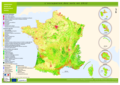 Occupation des sols en France en 2012, Corine Land Cover.png 1,753 × 1,241; 849 KB


