Category:Maps of land use in Europe
Jump to navigation
Jump to search
Subcategories
This category has the following 4 subcategories, out of 4 total.
C
- CORINE Land Cover (28 F)
F
Media in category "Maps of land use in Europe"
The following 17 files are in this category, out of 17 total.
-
 Cartello RN Lago di Villa.JPG 2,816 × 2,112; 2.76 MB
-
 Europe land use map.png 1,004 × 740; 640 KB
-
 Land of Skåne.png 320 × 311; 5 KB
-
 Lange diercke sachsen deutschland bodennutzung.jpg 2,544 × 1,975; 5.53 MB
-
 Lange diercke sachsen europa bodenbenutzung.jpg 1,248 × 1,589; 883 KB
-
 Map Land use capability 1990 - Touring Club Italiano CART-TEM-065.jpg 5,000 × 3,424; 10.67 MB
-
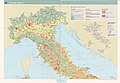 Map Land use I 1989 - Touring Club Italiano CART-TEM-063.jpg 5,000 × 3,440; 12 MB
-
 Map Land use II 1989 - Touring Club Italiano CART-TEM-064.jpg 5,000 × 3,399; 9.9 MB
-
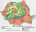 Romania land use (1970).jpg 772 × 697; 166 KB
-
 Romania landuse (1990).jpg 756 × 1,004; 134 KB
-
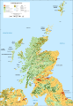 Scotland land cover map-en.svg 2,090 × 3,015; 1.27 MB
-
 Scotland land cover map-fr.svg 2,090 × 3,015; 1.27 MB
-
 Scotland land cover map-mk.svg 2,090 × 3,015; 1.91 MB
-
 Scotland land cover map-sco.svg 2,090 × 3,015; 1.27 MB
-
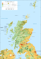
 Scotland Land Use by height.png 1,597 × 2,488; 181 KB
-
 SoilsCompaction UE EEA FR.jpg 1,454 × 1,300; 642 KB
-
 Sweden Land.png 390 × 852; 15 KB


.jpg)
.jpg)


