Category:Agricultural maps of France
Jump to navigation
Jump to search
Subcategories
This category has the following 8 subcategories, out of 8 total.
A
M
O
W
Media in category "Agricultural maps of France"
The following 17 files are in this category, out of 17 total.
-
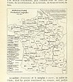
488 of 'La France Illustrée- géographie générale ... Par F. J' (11292784473).jpg 1,048 × 1,063; 251 KB
-
494 of 'La France Illustrée- géographie générale ... Par F. J' (11293351004).jpg 1,271 × 1,431; 510 KB
-
495 of 'La France Illustrée- géographie générale ... Par F. J' (11293350634).jpg 1,271 × 1,470; 578 KB
-
50 of '(Longmans' Junior School Geography, etc.)' (11212070386).jpg 2,704 × 2,001; 1.14 MB
-
520 of 'La France Illustrée- géographie générale ... Par F. J' (11292183584).jpg 1,258 × 1,433; 470 KB
-
Carte vente glyphosate en France.jpg 923 × 882; 120 KB
-
Croquis agriculture.png 1,386 × 961; 177 KB
-
Elev sel Grivette 2010.png 624 × 600; 94 KB
-
Elev sel Merinos d'Arles 2010.png 624 × 600; 102 KB
-
France, Agriculture, industrie et commerce - par J. Forest... - btv1b531212419.jpg 15,848 × 12,185; 31.43 MB
-
Nouvelle-Calédonie répartition culture 2012.svg 708 × 591; 181 KB
-
Nouvelle-Calédonie surface et exploitations agricoles 2012.svg 708 × 591; 169 KB
-
Schema agriculture.png 1,327 × 961; 118 KB
-
Schema potentialite.png 1,305 × 961; 135 KB
-
Zone de production du cidre breton (2014).svg 592 × 296; 4.98 MB


