Category:Land use maps
Jump to navigation
Jump to search
visual representation of the use of a unit of land at a particular point in time  Land se map of Honduras, 1983 | |||||
| Upload media | |||||
| Instance of | |||||
|---|---|---|---|---|---|
| Subclass of | |||||
| Named after | |||||
| Different from | |||||
| |||||
Subcategories
This category has the following 2 subcategories, out of 2 total.
L
- Land use maps of Brazil (5 F)
M
Media in category "Land use maps"
The following 44 files are in this category, out of 44 total.
-
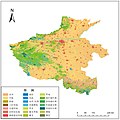 2015年河南省土地覆被分类图.jpg 2,893 × 2,893; 2.09 MB
-
 Anthromes map and timeline (10,000 BCE to 2017 CE).png 4,900 × 2,817; 5.03 MB
-
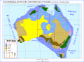 Australia Agriculture-Forestry-Fishing-Hunting Map-sr.svg 1,146 × 840; 2.31 MB
-
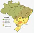 Brazil land 1977.jpg 770 × 749; 133 KB
-
 Carte du marais de Montfort.png 1,336 × 1,692; 1.14 MB
-
 Colombia land 1970.jpg 744 × 963; 153 KB
-
 DamierCentralités.png 593 × 373; 20 KB
-
 DamierThéorique.png 504 × 271; 5 KB
-
 Federal lands in Oregon.png 2,469 × 2,081; 479 KB
-
 Figure7.Changes in land-use in time.jpg 1,049 × 1,696; 439 KB
-
 General survey of the U.S.S.R. LOC 77695775.jpg 12,617 × 8,239; 11.81 MB
-
 Georgia Landuse Map.png 3,086 × 3,450; 1.5 MB
-
 Haack Insert 2 Wad Medani.png 534 × 486; 657 KB
-
 Honduras land 1983.jpg 960 × 838; 142 KB
-
 Land cvoer af 2018.jpg 3,300 × 2,400; 4.71 MB
-
 Land Use in the Potomac Basin.gif 900 × 673; 232 KB
-
 Land use, 1967.jpg 2,880 × 2,161; 886 KB
-
 Lange diercke sachsen afrika bodennutzung.jpg 1,256 × 1,366; 726 KB
-
 Lange diercke sachsen afrika oase siwa.jpg 718 × 700; 242 KB
-
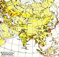 Lange diercke sachsen asien bodennutzung.jpg 1,573 × 1,528; 1.1 MB
-
 Lange diercke sachsen dresden bodennutzung.jpg 1,277 × 988; 821 KB
-
 Lange diercke sachsen vereinigte staaten bodennutzung.jpg 969 × 1,054; 481 KB
-
 Lebak land classification map.png 977 × 536; 42 KB
-
 Mixte1.png 407 × 269; 28 KB
-
 Mixte2.png 392 × 354; 34 KB
-
 Nicaragua land 1979.jpg 962 × 608; 138 KB
-
 Nicaragua-Costa Rica - Panama Land Use - DPLA - 781bc7345dccb86b218ae89cecd31c99.jpg 9,586 × 8,509; 8.77 MB
-
 Niger ag land use map USGS.png 800 × 267; 131 KB
-
 Radioconcentrique.png 374 × 262; 29 KB
-
 RezoningBirkenheadLibrarysite.jpg 4,224 × 2,816; 1.87 MB
-
 RUBI.PNG 432 × 311; 296 KB
-
 Simple landcover heihe.png 3,506 × 2,481; 159 KB
-

-
 SuoloBolotana.tiff 711 × 565; 90 KB
-
 TallaLandUse.jpg 1,060 × 1,060; 482 KB
-
 U.S.S.R. summary map. 9-68. LOC gm70003085.jpg 12,048 × 9,052; 9.06 MB
-
 U.S.S.R.; major terrain features. 5-69. LOC gm70004100.jpg 8,340 × 6,417; 4.74 MB
-
 Uso actual del suelo.jpg 890 × 1,114; 108 KB
-
 Uso de suelo del municipio de Uriangato.JPG 518 × 655; 44 KB
-
 West Newton Land Use Map 2021.jpg 1,536 × 1,201; 341 KB
-
 World vegetation zones.png 2,753 × 1,400; 200 KB
-
 Yangon-2008.JPG 370 × 298; 28 KB
-
 Yangon-land-use-2008.jpg 640 × 400; 30 KB
-
 ZONAS CAP.jpg 665 × 498; 123 KB

.png)


.jpg)


