Category:Maps of beltways in the Netherlands
Jump to navigation
Jump to search
Media in category "Maps of beltways in the Netherlands"
The following 8 files are in this category, out of 8 total.
-
Ringweg Assen.jpg 1,721 × 1,902; 1.9 MB
-
Centrumring (Den Haag).jpg 582 × 575; 126 KB
-
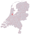
RingHoofddorp.jpg 560 × 422; 157 KB
-
Houten Ringweg.png 1,600 × 1,560; 5.67 MB
-
KnooppuntWatergraafsmeer.PNG 225 × 261; 15 KB
-
Rijksweg10.svg 801 × 924; 959 KB
-
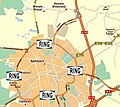
Ring-apeldoorn.jpg 393 × 350; 52 KB
-
RingwegA10.png 476 × 347; 15 KB


