Category:Maps of the Egyptian New Kingdom
Jump to navigation
Jump to search
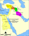
English: The New Kingdom, sometimes referred to as the Egyptian Empire, is the period in ancient Egyptian history between the 16th century BC and the 11th century BC, covering the Eighteenth, Nineteenth, and Twentieth Dynasties of Egypt. The New Kingdom (1570–1070 BC) followed the Second Intermediate Period and was succeeded by the Third Intermediate Period. It was Egypt’s most prosperous time and marked the zenith of its power.
Subcategories
This category has the following 2 subcategories, out of 2 total.
M
- Maps of the Battle of Kadesh (15 F)
- Maps of the Valley of the Kings (35 F)
Media in category "Maps of the Egyptian New Kingdom"
The following 83 files are in this category, out of 83 total.
-
 14 century BC Eastern ca.svg 1,001 × 557; 92 KB
-
 14 century BC Eastern Mediterranean and the Middle East.png 1,041 × 578; 579 KB
-
 14 century BC Eastern-ar.svg 1,001 × 557; 883 KB
-
 14 century BC Eastern-es.svg 1,001 × 557; 367 KB
-
 14 century BC Eastern-pt.svg 1,001 × 557; 377 KB
-
 14 century BC Eastern.El.png 1,034 × 574; 566 KB
-
 MACCOUN(1899) p047 ABOUT 1440 B.C. - LOWER EGYPT.jpg 1,954 × 3,602; 2.63 MB
-
 MACCOUN(1899) p083 ABOUT 1230 B.C..jpg 1,978 × 3,582; 2 MB
-

-
 Alter Orient 1100BC.svg 2,102 × 1,510; 4.79 MB
-
 Alter Orient 1200BC-es.svg 2,102 × 1,510; 3.57 MB
-
 Alter Orient 1200BC.svg 2,102 × 1,510; 4.71 MB
-
 Alter Orient 1300BC.svg 2,102 × 1,510; 4.71 MB
-
 Alter Orient 1400BC-pt.svg 2,060 × 1,471; 5.69 MB
-
 Alter Orient 1400BC.svg 2,102 × 1,510; 4.82 MB
-
 Alter Orient 1500BC.svg 2,102 × 1,510; 4.95 MB
-
 AlterOrient2.png 1,394 × 1,118; 1.67 MB
-
 Altes Reich.png 438 × 670; 55 KB
-
 Amarna (cropped).JPG 420 × 677; 54 KB
-
 Amarna map large.jpg 553 × 549; 29 KB
-
 Amarna Map.png 1,080 × 1,169; 56 KB
-
 Amarnamap.png 782 × 607; 743 KB
-
 Ancient Eastern Empires (Atlas of European history, 1909).PNG 1,827 × 1,251; 2.51 MB
-
 Ancient Egypt and Mesopotam-es.png 1,200 × 1,473; 288 KB
-
 Ancient Egypt and Mesopotamia c. 1450 BC af.png 1,200 × 1,473; 264 KB
-
 Ancient Egypt and Mesopotamia c. 1450 BC.png 1,200 × 1,473; 259 KB
-
 Ancient Egypt map pl.svg 1,320 × 1,500; 273 KB
-
 Ancient Near East 1100BC.svg 2,102 × 1,510; 4.78 MB
-
 Ancient Near East 1200BC.svg 2,102 × 1,510; 4.7 MB
-
 Ancient Near East 1300BC.svg 2,102 × 1,510; 4.71 MB
-
 Ancient Near East 1400BC.svg 2,102 × 1,510; 4.81 MB
-
 Ancient Near East 1500BC.svg 2,102 × 1,510; 4.93 MB
-
 Bronze Age End (Indonesian version).svg 1,151 × 812; 1.37 MB
-
 Bronze Age End-pt.svg 1,151 × 812; 1.37 MB
-
 Bronze Age End.svg 1,151 × 812; 1.43 MB
-
 C+B-Syria-Map2-AccordingToAmarnaLetters.JPG 670 × 2,048; 503 KB
-
 Egipt i Bliski Wschód za Tutmozydów.png 800 × 600; 63 KB
-
 Egipt- Novo kraljestvo.PNG 566 × 1,035; 111 KB
-
 Egito pt.svg 744 × 744; 100 KB
-
 Egypt 1400 fKr.svg 1,282 × 1,501; 247 KB
-
 Egypt 1450 BC ar.svg 1,300 × 1,500; 442 KB
-
 Egypt 1450 BC CZ.svg 1,387 × 1,600; 223 KB
-
 Egypt 1450 BC fr.svg 1,300 × 1,500; 257 KB
-
 Egypt 1450 BC hr.svg 1,300 × 1,500; 252 KB
-
 Egypt 1450 BC mk.svg 1,300 × 1,500; 481 KB
-
 Egypt 1450 BC vi.svg 512 × 591; 90 KB
-
 Egypt 1450 BC-es.svg 1,300 × 1,500; 252 KB
-
 Egypt 1450 BC.svg 1,300 × 1,500; 257 KB
-
 Egypt NK edit es.svg 1,282 × 1,501; 251 KB
-
 Egypt NK edit-ar.svg 1,282 × 1,501; 247 KB
-
 Egypt NK edit-eo.svg 1,282 × 1,501; 259 KB
-
 Egypt NK edit-nl.svg 1,282 × 1,501; 258 KB
-
 Egypt NK edit-pt.svg 1,276 × 1,501; 148 KB
-
 Egypt NK edit-sk.svg 1,282 × 1,501; 461 KB
-
 Egypt NK edit-sr.svg 1,282 × 1,501; 252 KB
-
 Egypt NK edit-zh-hans.svg 1,282 × 1,501; 254 KB
-
 Egypt NK edit.svg 1,282 × 1,501; 252 KB
-
 Egypte 1450 v.Chr.svg 1,300 × 1,500; 346 KB
-
-
 Egyptian Empire, B.C. 1450 (2710782990).jpg 1,245 × 2,000; 2.2 MB
-
 Egyptian Empire, B.C. 1450 (Bartholomew, J. G. 1913).jpg 2,248 × 3,612; 3.08 MB
-
 Hayassa-Hayasan.jpg 5,906 × 4,429; 3.22 MB
-
 Hitt Egypt 1450 bc ca.svg 1,300 × 1,500; 248 KB
-
 Hitt Egypt 1450 bc-edit1.svg 413 × 469; 263 KB
-
 Hitt Egypt 1450 bc.svg 1,300 × 1,500; 248 KB
-
 Hitt Egypt Perseus.png 850 × 850; 311 KB
-
 Hittite Empire he.png 500 × 529; 79 KB
-
 Hittite Empire.png 500 × 529; 219 KB
-
 Hittites 1300bc.jpg 1,285 × 1,008; 520 KB
-
-
 Ludy Morza (Sea Peoples).jpg 3,273 × 2,024; 705 KB
-
 Mapaderienteproximo.svg 1,115 × 865; 11.13 MB
-
 Mapaderienteproximosinrelieve.svg 1,115 × 865; 8.74 MB
-
 Neues Reich.png 432 × 646; 69 KB
-
 Nieuwe Rijk.PNG 432 × 646; 68 KB
-
 Nomes of Ancient Egypt.png 267 × 592; 57 KB
-
 Starożytny Bliski Wschód po bitwie pod Kadesz XIII w. p.n.e..jpg 2,457 × 1,729; 449 KB
-
 Starożytny Bliski Wschód w XV wieku p.n.e. (Ancient Near East 1450 B.C.).jpg 8,512 × 8,058; 10.17 MB
-
 Syropalestyna w czasach dominacji egipskiej XIV wiek p.n.e..jpg 2,382 × 2,383; 444 KB
-
 Ägyptens größte Ausdehnung.jpg 757 × 630; 213 KB
-
 Древний Египет. Северная Африка.png 1,024 × 695; 323 KB
-
 Древний Египет.svg 1,024 × 695; 147 KB
-
 خريطة تقريبية تبين الموقع المحتمل لبلاد البنط بونت المنتج للبخور.png 800 × 923; 218 KB


_p047_ABOUT_1440_B.C._-_LOWER_EGYPT.jpg)
_p083_ABOUT_1230_B.C..jpg)
%27_(11251022305).jpg)


.JPG)


.PNG)


.svg)


.jpg)
.jpg)


.jpg)


.jpg)


