Category:Maps of Yorkshire and the Humber
Jump to navigation
Jump to search
Wikimedia category | |||||
| Upload media | |||||
| Instance of | |||||
|---|---|---|---|---|---|
| Category combines topics | |||||
| Yorkshire and the Humber | |||||
one of nine regions of England | |||||
| Instance of | |||||
| Location | England | ||||
| Population |
| ||||
| Area |
| ||||
 | |||||
Subcategories
This category has the following 9 subcategories, out of 9 total.
E
H
L
N
O
S
W
Media in category "Maps of Yorkshire and the Humber"
The following 20 files are in this category, out of 20 total.
-
ENG-yh-eyorks.png 375 × 300; 36 KB
-
England Region - Yorkshire and Humber.svg 525 × 650; 83 KB
-
EnglandYorkshireHumber.png 200 × 247; 15 KB
-
EnglandYorkshireHumberNumbered.png 200 × 158; 21 KB
-
Map of Northern England.png 1,479 × 1,080; 301 KB
-
Northern England within the UK.png 1,821 × 3,089; 754 KB
-
Northern England.svg 816 × 991; 594 KB
-
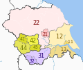
NUTS 3 regions of Yorkshire and the Humber 2010 map.svg 1,425 × 1,212; 1.24 MB
-
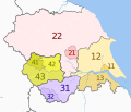
NUTS 3 regions of Yorkshire and the Humber map.svg 1,425 × 1,212; 1.24 MB
-
State of the Civil War in Yorkshire, January 1643.png 463 × 235; 8 KB
-
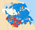
United Kingdom AV referendum Yorkshire and the Humber results.svg 1,425 × 1,212; 1.22 MB
-
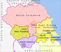
Yorkshire & The Humber counties.png 1,104 × 940; 169 KB
-
Yorkshire and the Humber constituencies 2011 map.svg 1,425 × 1,212; 1.61 MB
-
Yorkshire and the Humber counties 2009 map.svg 1,425 × 1,212; 1.25 MB
-
Yorkshire and the Humber counties 2023 map.svg 1,425 × 1,212; 1.09 MB
-
Yorkshire and the Humber districts 2011 map.svg 1,425 × 1,212; 1.22 MB
-
Yorkshire and the Humber in England.png 814 × 953; 107 KB
-
Yorkshire and the Humber in England.svg 816 × 991; 996 KB
-
Yorkshire and the Humber wards 2011 map coloured.svg 1,425 × 1,212; 3.75 MB
-
Yorkshire and the Humber wards 2011 map.svg 1,425 × 1,212; 3.74 MB


