Category:Maps of Worms
Jump to navigation
Jump to search
Urban districts (cities): Frankenthal · Coblenz · Landau · Ludwigshafen · Mainz · Neustadt an der Weinstrasse · Speyer · Trier · Zweibrücken
Subcategories
This category has the following 2 subcategories, out of 2 total.
O
Media in category "Maps of Worms"
The following 12 files are in this category, out of 12 total.
-
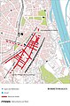 Borbetomagus Straßennetz.jpg 2,917 × 4,425; 1.69 MB
-
 Locator map WO in Rhineland-Palatinate.svg 708 × 913; 627 KB
-
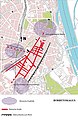 Römische Friedhöfe Borbetomagus.jpg 2,894 × 4,437; 1.85 MB
-
 Stadtbefestigung Worms.jpg 2,917 × 4,724; 5.41 MB
-
 StrB Gleisplan.jpg 14,173 × 10,630; 5.15 MB
-
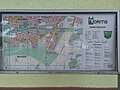 Weinsheim Map.jpg 4,032 × 3,024; 8.1 MB
-
 WO in Rheinland-Pfalz.svg 574 × 744; 133 KB
-
 Worms Marktplatz Gegenwart.svg 512 × 512; 4 KB
-
 Worms Marktplatz um 1910.svg 512 × 512; 4 KB
-
 Worms Marktplatz vor 1891.svg 512 × 512; 4 KB
-
 Worms Stadtbezirke.png 1,200 × 1,033; 3.55 MB
-
 Worms-Position.png 188 × 235; 5 KB


