Category:Maps of Frankenthal (Pfalz)
Jump to navigation
Jump to search
Urban districts (cities): Frankenthal · Coblenz · Landau · Ludwigshafen · Mainz · Neustadt an der Weinstrasse · Speyer · Trier · Zweibrücken
Media in category "Maps of Frankenthal (Pfalz)"
The following 8 files are in this category, out of 8 total.
-
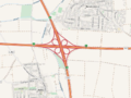 AK Frankenthal map.png 818 × 613; 548 KB
-
 Franckenthal ; Mannheim - btv1b532387272 (1 of 2).jpg 5,796 × 8,511; 9.45 MB
-
 FT in Rheinland-Pfalz.svg 574 × 744; 133 KB
-
 LASB K Hellwig 1016.jpg 4,824 × 4,214; 4.14 MB
-
 Locator map FT in Rhineland-Palatinate.svg 708 × 913; 626 KB
-
 Palatinatus Rheni (Merian) 059.jpg 2,000 × 1,512; 421 KB
-
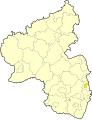
 Rhineland p stadt ft.png 419 × 503; 12 KB
-
 Wahrmund Die Pfalz 1691 Franckentahl.jpg 1,224 × 700; 539 KB

.jpg)


_059.jpg)

