<nowiki>Category:Maps of Landkreis Bad Dürkheim; categoría de Wikimedia; Wikimedia-categorie; 维基媒体分类; категория в проекте Викимедиа; kategorija na Wikimediji; Викимедиина категорија; Kategoriya ning Wikimedia; kategori Wikimedia; kategori Wikimedia; 維基媒體分類; Wikimedia-categorie; categorie în cadrul unui proiect Wikimedia; Wikimedia category; د ويکيمېډيا وېشنيزه; категория на Уикимедия; kategoria w projekcie Wikimedia; Vikimedya kategorisi; categurìa 'e nu pruggette Wikimedia; kategori Wikimedia; ویکیمیڈیا زمرہ; Wikimedia-kategori; Wîkîmediya:Kategorî; категорія проєкту Вікімедіа; kawan Wikimèdia; гурӯҳи Викимедиа; 维基媒体分类; Wikimedia-Kategorie; 위키미디어 분류; Wikimedia-bólkur; kategorio en Vikimedio; kategorie na projektech Wikimedia; Wikimedia-Kategorie; Wikimedia:Ronnaghys; উইকিমিডিয়া বিষয়শ্রেণী; page de catégorie de Wikimedia; kategori Wikimedia; kategorija na Wikimediji; Wikimedia proyektındağı törkem; 维基媒体分类; Wikimedia-Kategorie; Wikimedia-categorie; विकिपीडिया वर्ग; kategorija w projektach Wikimedije; thể loại Wikimedia; Wikimedia-Kategorie; Wikimedia projekta kategorija; kategoria ti Wikimedia; категорија на Викимедији; 維基媒體分類; Wikimedia-kategory; categoria de um projeto da Wikimedia; Wikimedia category; категорияд Ангилал; Wikimedia-kategori; Wikimedia-kategori; kategori Wikimédia; kategori Wikimedia; 维基媒体分类; ვიკიპედია:კატეგორიზაცია; پۆلی ویکیمیدیا; Wikimedia category; تصنيف ويكيميديا; Vikimédia ñemohenda; Wikimedia:Klassys; Wikimedia:ကဏ္ဍခွဲခြင်း; 維基媒體分類; Wikimedia категориясы; વિકિપીડિયા શ્રેણી; 維基媒體分類; Wikimediako kategoria; categoría de Wikimedia; categoría de Wikimedia; categoria de Wikimedia; Викимедиа категорияһы; tudalen categori Wikimedia; kategori e Wikimedias; Viciméid catagóir; ردهٔ ویکیپدیا; Wikimedia-kategorie; Wikimedia-kategori; विकिमिडिया श्रेणी; ウィキメディアのカテゴリ; Wikimedia-Kategorie; Wikimedia-luokka; تصنيف بتاع ويكيميديا; 維基媒體分類; විකිමීඩියා ප්රභේද පිටුව; categoria Vicimediorum; categoria Wikimedia; Vikipidiya:Shopni; Wikimédia-kategória; Wikimedia-kategoriija; гурӯҳ дар лоиҳаи Викимедиа; Wikimedia category; 维基媒体分类; விக்கிமீடியப் பகுப்பு; categoria di un progetto Wikimedia; gurühi Vikimedia; विकिपीडिया:श्रेणी; pajenn rummata eus Wikimedia; Wikimedia kategooria; विकिमीडिया श्रेणी; Викимедиа проектындагы төркем; Викимедиа проектындагы төркем; דף קטגוריה; ẹ̀ka Wikimedia; catigurìa di nu pruggettu Wikimedia; categoria de um projeto da Wikimedia; Վիքիմեդիայի նախագծի կատեգորիա; катэгорыя ў праекце Вікімедыя; tumbung Wikimedia; Wikimedia-Kategorie; kategorija Wikimedie; kategorya ng Wikimedia; катэгорыя ў праекце Вікімэдыя; विकिमिडिया श्रेणी; หน้าหมวดหมู่วิกิมีเดีย; jamii ya Wikimedia; വിക്കിമീഡിയ വർഗ്ഗം; Wikimedia:Kategorija; kategori Wikimedia; Wikimedia-kategorie; زمرو:وڪيپيڊيا زمرا بندي; Wikimedia-Kategorie; categoría de Wikimedia; Wikimedia-Kategorie; κατηγορία εγχειρημάτων Wikimedia; kategória projektov Wikimedia</nowiki>
Subcategories
This category has the following 2 subcategories, out of 2 total.


 DÜW in Rheinland-Pfalz.svg 574 × 744; 133 KB
 20201011Weinstraße 67 Forst6.jpg 1,000 × 750; 189 KB
 20201011Weinstraße 67 Forst7.jpg 1,000 × 750; 209 KB
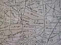 20201011Weinstraße 67 Forst8.jpg 2,750 × 2,063; 1.39 MB
 Karte Landkreis Bad Dürkheim.gif 600 × 588; 37 KB
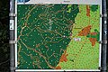 Karte Wanderwege Deidesheim 5234.jpg 2,728 × 1,816; 1.55 MB
 Kuckucksbaehnel.png 714 × 397; 111 KB
 Kuckucksbähnel Strecke.png 1,406 × 624; 447 KB
 Lage des Landkreises Bad Dürkheim in Deutschland.png 197 × 235; 3 KB
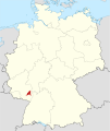 Locator map DÜW in Germany.svg 1,075 × 1,273; 513 KB
 Locator map DÜW in Rhineland-Palatinate.svg 708 × 913; 626 KB
 OAN Grenzen und Orte 17982d.png 1,099 × 1,297; 150 KB


