Category:Maps of Sumatra
Jump to navigation
Jump to search
Wikimedia category | |||||
| Upload media | |||||
| Instance of | |||||
|---|---|---|---|---|---|
| Category combines topics | |||||
| Sumatra | |||||
island in western Indonesia, westernmost of the Sunda Islands | |||||
| Instance of | |||||
| Part of | |||||
| Location | Greater Sunda Islands, Sunda Islands | ||||
| Located in or next to body of water | |||||
| Width |
| ||||
| Length |
| ||||
| Highest point |
| ||||
| Population |
| ||||
| Area |
| ||||
| Elevation above sea level |
| ||||
| Different from | |||||
 | |||||
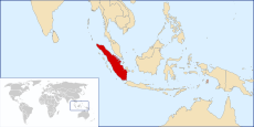
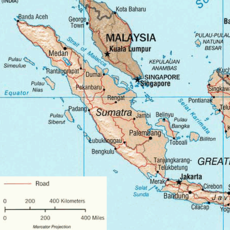
May only include maps that focus on the island of Sumatra. If other major islands of Indonesia are visible, use other categories, such as Category:Maps of western Indonesia. If showing the location of Sumatra in relation with Indonesia, use Category:Locator maps of Sumatra. If not showing the whole of Sumatra, use the province level category(/categories).
Subcategories
This category has the following 9 subcategories, out of 9 total.
Media in category "Maps of Sumatra"
The following 27 files are in this category, out of 27 total.
-
EQs 1900-2016 sumatra tsum.png 732 × 997; 1.33 MB
-
Fires aqua sumatra 14oct04.jpg 540 × 540; 110 KB
-
Fossil sites in Sumatra.jpg 1,099 × 1,288; 814 KB
-
IMG Wahyu.jpg 1,080 × 1,877; 620 KB
-
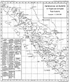
Junghuhns Fahrten von Batavia nach Sumatra und zurück.jpg 645 × 589; 81 KB
-
Northern-Sumatra.gif 382 × 490; 26 KB
-
Peta Geologi Jambi Zaman Hindia Belanda.jpg 5,000 × 3,320; 3.86 MB
-
Peta Jalan Tol Trans Sumatra.jpg 2,550 × 3,300; 490 KB
-
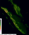
S 6.2 E 94.8 - N 8.4, E 107 slope map.png 8,282 × 9,938; 18.66 MB
-
September 2007 Sumatra quake.gif 350 × 467; 73 KB
-
Straat Karimata.JPG 446 × 446; 46 KB
-
Sumatra admin.jpg 446 × 446; 47 KB
-
Sumatra map.jpg 476 × 530; 97 KB
-
Sumatra mappa it.png 558 × 556; 188 KB
-
Sumatra pol 2002.jpg 453 × 504; 77 KB
-
Sumatra regions map.png 1,783 × 1,678; 839 KB
-
Sumatra Volcanoes.png 600 × 527; 141 KB
-
Sumatra.png 446 × 446; 81 KB
-
Suured Sunda saared jm.png 872 × 1,058; 253 KB
-
Tectonic setting map of Sumatra.jpg 1,269 × 1,522; 460 KB
-
Terremoto de indonesia de 2016.jpg 612 × 716; 93 KB
-
Tsumap.jpg 591 × 738; 206 KB
-
USGS Sunda Trench.JPG 611 × 461; 62 KB
-
WV Sumatra map PNG.png 1,606 × 1,406; 452 KB
-
WV Sumatra map.png 1,783 × 1,678; 856 KB
-
Zonasi taman nasional kerinci seblat 2017.jpg 877 × 616; 253 KB
-
Физ. карта Суматры.png 1,968 × 1,881; 2.5 MB

