Category:Maps of North Sumatra
Jump to navigation
Jump to search
Wikimedia category | |||||
| Upload media | |||||
| Instance of | |||||
|---|---|---|---|---|---|
| Category combines topics | |||||
| North Sumatra | |||||
province of Indonesia  someja satełitar in marso     | |||||
| Instance of | |||||
| Location | Indonesia | ||||
| Located in or next to body of water | |||||
| Capital | |||||
| Official language | |||||
| Head of government |
| ||||
| Inception |
| ||||
| Population |
| ||||
| Area |
| ||||
| Elevation above sea level |
| ||||
| Replaces |
| ||||
| official website | |||||
 | |||||

Subcategories
This category has the following 10 subcategories, out of 10 total.
Media in category "Maps of North Sumatra"
The following 24 files are in this category, out of 24 total.
-
 12 Sumatra Utara.png 4,938 × 3,000; 3.29 MB
-
 Admiralty Chart No 1353 Diamond Point to Pulo Barhala, Published 1897.jpg 7,913 × 10,902; 30.09 MB
-
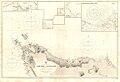 Admiralty Chart No 219 Achin Head to Diamond Point, Published 1877, Large Corrections 1906.jpg 15,901 × 10,882; 44.5 MB
-
 Admiralty Chart No 855 (star) Tappanooly Harbour, Published 1795.jpg 8,352 × 6,206; 9.04 MB
-
 Foto Peta Kerajaan Serdang (1907).jpg 3,024 × 4,032; 2.48 MB
-
 Hutan Lindung dan Taman Nasional Batang Gadis.jpg 1,122 × 793; 235 KB
-
 Hutan Shrew area.png 644 × 452; 13 KB
-
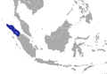
 Indonesia, North Sumatra.png 800 × 375; 97 KB
-
 Karte Pulau Nias.jpg 4,619 × 4,458; 4.96 MB
-
 Location map Northern Sumatra.png 791 × 645; 78 KB
-
 Locator Binjai.jpg 419 × 318; 14 KB
-
 Locator kabupaten mandailing.jpg 400 × 377; 22 KB
-
 Locator north sumatra.png 300 × 206; 28 KB
-
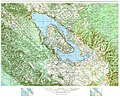 Map of Lake Toba.jpg 4,037 × 3,282; 4.76 MB
-
 MArco Polo's journey in India and Malay countries.jpg 2,416 × 1,459; 1.11 MB
-
 Peta Lokasi Kecamatan Pandan Kabupaten Tapanuli Tengah.png 600 × 600; 102 KB
-
 Peta Wilayah Kecamatan Sunggal, Kabupaten Deli Serdang.jpg 3,384 × 3,008; 2.86 MB
-
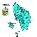 Prov. Sumatera Utara.jpg 1,280 × 1,280; 535 KB
-
 Psm dan hutan lindung.jpg 1,121 × 793; 270 KB
-
 Psm tanpa hutan lindung.jpg 1,121 × 793; 272 KB
-
 Reliefkarte Battalaender.jpg 891 × 1,109; 278 KB
-
 Sumatra Utara chrétiens 2010.png 1,669 × 2,824; 1.19 MB
-
 Sumatra Utara Map.png 560 × 695; 115 KB
-
 Sumatra Utara.png 400 × 163; 26 KB


_Tappanooly_Harbour,_Published_1795.jpg)
.jpg)


