Category:Maps of Aceh
Appearance
Wikimedia category | |||||
| Upload media | |||||
| Instance of | |||||
|---|---|---|---|---|---|
| Category combines topics | |||||
| Aceh | |||||
province of Indonesia | |||||
| Audio | |||||
| Instance of | |||||
| Location | Indonesia | ||||
| Located in or next to body of water | |||||
| Capital | |||||
| Official language | |||||
| Head of government |
| ||||
| Inception |
| ||||
| Population |
| ||||
| Area |
| ||||
| Elevation above sea level |
| ||||
| Religion or worldview | |||||
| Different from | |||||
| official website | |||||
 | |||||
Subcategories
This category has the following 5 subcategories, out of 5 total.
Media in category "Maps of Aceh"
The following 31 files are in this category, out of 31 total.
-
11 Aceh.png 4,925 × 3,000; 3.03 MB
-
2004 indian ocean earthquake details.png 413 × 408; 26 KB
-
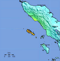
2008 Aceh earthquake.PNG 466 × 471; 125 KB
-
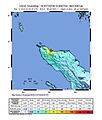
2016 Aceh Earthquake Shakemap.jpg 612 × 717; 73 KB
-
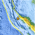
7,2 Sumatra.jpg 612 × 712; 82 KB
-
Aceh (Sumatra, Indonesia).png 1,920 × 880; 366 KB
-
Aceh Barat Daya.jpg 790 × 749; 62 KB
-
Aceh dati2l.jpg 300 × 500; 22 KB
-
Aceh in Indonesien.png 275 × 105; 23 KB
-
Aceh-Batak war.png 2,268 × 2,160; 1.08 MB
-
Aceh-Karte.png 400 × 163; 21 KB
-
Banda Aceh location.png 316 × 269; 14 KB
-
Banyak Islands.jpg 1,493 × 1,602; 286 KB
-
Hutan Shrew area.png 644 × 452; 13 KB
-
Indonesia quake location.gif 142 × 142; 21 KB
-
Indonesia SabangMerauke.PNG 400 × 163; 23 KB
-
IndonesiaAceh.png 800 × 375; 97 KB
-
Kabupaten Aceh Tenggara Selatan-Lawe Alas.png 3,264 × 2,206; 878 KB
-
Location map Indonesia Aceh.png 1,782 × 1,351; 683 KB
-
Locator Aceh final.png 300 × 232; 21 KB
-
Locator kab aceh besar.png 300 × 182; 16 KB
-
Locator kota sabang.png 300 × 192; 17 KB
-
Mapa terremoto de Indonesia de 2012.png 540 × 558; 92 KB
-
Pasai.jpg 348 × 256; 53 KB
-
Peta adm kec pandrah.jpg 3,288 × 4,251; 1.78 MB
-
Peta Kuala Simpang, Sungai Tamiang, Aceh.png 1,366 × 768; 1.56 MB
-
Peuta Narit Aceh.GIF 380 × 450; 5 KB
-
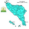
Prov. DI Aceh.jpg 1,280 × 1,280; 449 KB
-
Pulau Aceh.jpg 761 × 628; 185 KB
-
Sultanate of Aceh.png 2,900 × 3,770; 629 KB
-
Tamiang - Kuala Simpang - Aceh.png 1,366 × 768; 2 MB


