Category:Maps of St. Lawrence County, New York
Jump to navigation
Jump to search
Counties of New York (state): Albany · Allegany · Bronx · Broome · Cattaraugus · Cayuga · Chautauqua · Chemung · Chenango · Clinton · Columbia · Cortland · Delaware · Dutchess · Erie · Essex · Franklin · Fulton · Genesee · Greene · Hamilton · Herkimer · Jefferson · Kings · Lewis · Livingston · Madison · Monroe · Montgomery · Nassau · New York · Niagara · Oneida · Onondaga · Ontario · Orange · Orleans · Oswego · Otsego · Putnam · Queens · Rensselaer · Richmond · Rockland · Saratoga · Schenectady · Schoharie · Schuyler · Seneca · St. Lawrence · Steuben · Suffolk · Sullivan · Tioga · Tompkins · Ulster · Warren · Washington · Wayne · Westchester · Wyoming · Yates
Wikimedia category | |||||
| Upload media | |||||
| Instance of | |||||
|---|---|---|---|---|---|
| Category combines topics | |||||
| St. Lawrence County | |||||
county in New York, United States .jpg)  | |||||
| Instance of | |||||
| Named after | |||||
| Location | New York | ||||
| Capital | |||||
| Inception |
| ||||
| Population |
| ||||
| Area |
| ||||
| Different from | |||||
| official website | |||||
 | |||||
Subcategories
This category has the following 2 subcategories, out of 2 total.
Media in category "Maps of St. Lawrence County, New York"
The following 44 files are in this category, out of 44 total.
-
 1944 Cornwall Massena Isoseismal Map.png 651 × 530; 124 KB
-
 359 of 'A history of St. Lawrence and Franklin Counties, New York' (11041982786).jpg 3,450 × 2,685; 1.56 MB
-
 457 of 'A history of St. Lawrence and Franklin Counties, New York' (11041179635).jpg 1,475 × 1,785; 648 KB
-
 481 of 'A history of St. Lawrence and Franklin Counties, New York' (11040187676).jpg 2,464 × 1,475; 1,006 KB
-
 79 of 'A history of St. Lawrence and Franklin Counties, New York' (11040347016).jpg 1,933 × 2,101; 373 KB
-
 Brasher (Township) NYPL1601918.tiff 6,178 × 5,428; 95.94 MB
-

-
 Brasher NY Locator Map.png 800 × 824; 49 KB
-
 Canton ny.png 800 × 824; 49 KB
-
 Clare NY Locator Map.png 800 × 824; 49 KB
-
 Clifton NY Locator Map.png 800 × 824; 49 KB
-
 Colton NY Locator Map.png 800 × 824; 49 KB
-
 De Kalb NY Locator Map.png 800 × 824; 49 KB
-
 De Peyster NY Locator Map.png 800 × 824; 49 KB
-
 Edwards NY Locator Map.png 800 × 824; 49 KB
-
 Fine NY Locator Map.png 800 × 824; 49 KB
-
 Fort de La Présentation.jpg 582 × 369; 152 KB
-
 Fowler NY Locator Map.png 800 × 824; 49 KB
-
 Gouverneur NY Locator Map.png 800 × 824; 49 KB
-
 Hermon NY Locator Map.png 800 × 824; 49 KB
-

-
 Hopkinton NY Locator Map.png 800 × 824; 49 KB
-
 Lisbonnylocatormap.png 800 × 824; 49 KB
-
 Louisville NY Locator Map.png 800 × 824; 49 KB
-
 Macomb NY Locator Map.png 800 × 824; 49 KB
-
 Madrid NY Locator Map.png 800 × 824; 49 KB
-
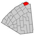
 Map of New York highlighting St. Lawrence County.svg 6,599 × 5,030; 112 KB
-
 Massena NY Locator Map.png 800 × 824; 48 KB
-
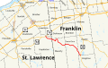 New York Route 458 Map with Labels.svg 760 × 475; 863 KB
-
 Norfolk NY Locator Map.png 800 × 824; 49 KB
-
 Ogdensburg NY Locator Map.png 800 × 824; 49 KB
-
 Oswegatchie NY Locator Map.png 800 × 824; 49 KB
-
 Parishville NY Locator Map.png 800 × 824; 49 KB
-
 Piercefield NY Locator Map.png 800 × 824; 49 KB
-
 Pierrepont NY Locator Map.png 800 × 824; 49 KB
-
 Pitcairn NY Locator Map.png 800 × 824; 49 KB
-
 Potsdam ny.png 800 × 824; 49 KB
-
 Rossie NY Locator Map.png 800 × 824; 48 KB
-
 Russell NY Locator Map.png 800 × 824; 49 KB
-
 New York State Senate District 45 (2012).png 3,259 × 2,492; 404 KB
-
 New York State Senate District 47 (2012).png 3,259 × 2,492; 404 KB
-
 New York State Senate District 48 (2012).png 3,259 × 2,492; 404 KB
-
 Stockholm NY Locator Map.png 800 × 824; 49 KB
-
 Waddington NY Locator Map.png 800 × 824; 49 KB

.jpg)
.jpg)
.jpg)
.jpg)


.png)
.png)
.png)

