Category:Maps of Cortland County, New York
Jump to navigation
Jump to search
Counties of New York (state): Albany · Allegany · Bronx · Broome · Cattaraugus · Cayuga · Chautauqua · Chemung · Chenango · Clinton · Columbia · Cortland · Delaware · Dutchess · Erie · Essex · Franklin · Fulton · Genesee · Greene · Hamilton · Herkimer · Jefferson · Kings · Lewis · Livingston · Madison · Monroe · Montgomery · Nassau · New York · Niagara · Oneida · Onondaga · Ontario · Orange · Orleans · Oswego · Otsego · Putnam · Queens · Rensselaer · Richmond · Rockland · Saratoga · Schenectady · Schoharie · Schuyler · Seneca · St. Lawrence · Steuben · Suffolk · Sullivan · Tioga · Tompkins · Ulster · Warren · Washington · Wayne · Westchester · Wyoming · Yates
Wikimedia category | |||||
| Upload media | |||||
| Instance of | |||||
|---|---|---|---|---|---|
| Category combines topics | |||||
| Cortland County | |||||
county in New York, United States ,_Cortland,_New_York.jpg)  | |||||
| Instance of | |||||
| Named after | |||||
| Location | New York | ||||
| Capital | |||||
| Inception |
| ||||
| Population |
| ||||
| Area |
| ||||
| Different from | |||||
| official website | |||||
 | |||||
Subcategories
This category has only the following subcategory.
Media in category "Maps of Cortland County, New York"
The following 20 files are in this category, out of 20 total.
-
 CNYMapleFestival2019GulfOneRoomSchoolhouseTownOfMarathonFrom1872MapOfCortlandCounty.jpg 3,036 × 4,048; 2.84 MB
-
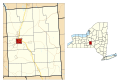
 Cortland County NY Cincinnatus town highlighted.svg 1,950 × 1,344; 1.14 MB
-
 Cortland County NY Cortland city highlighted.svg 1,950 × 1,344; 1.14 MB
-
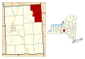
 Cortland County NY Cortlandville town highlighted.svg 1,950 × 1,344; 1.14 MB
-
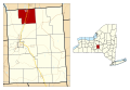
 Cortland County NY Cuyler town highlighted.svg 1,950 × 1,344; 1.14 MB
-
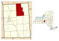
 Cortland County NY Freetown town highlighted.svg 1,950 × 1,344; 1.14 MB
-
 Cortland County NY Harford town highlighted.svg 1,950 × 1,344; 1.14 MB
-
 Cortland County NY Homer town highlighted.svg 1,950 × 1,344; 1.14 MB
-
 Cortland County NY Lapeer town highlighted.svg 1,950 × 1,344; 1.14 MB
-
 Cortland County NY Marathon town highlighted.svg 1,950 × 1,344; 1.14 MB
-
 Cortland County NY Preble town highlighted.svg 1,950 × 1,344; 1.14 MB
-
 Cortland County NY Scott town highlighted.svg 1,950 × 1,344; 1.14 MB
-
 Cortland County NY Solon town highlighted.svg 1,950 × 1,344; 1.14 MB
-
 Cortland County NY Taylor town highlighted.svg 1,950 × 1,344; 1.14 MB
-
 Cortland County NY Truxton town highlighted.svg 1,950 × 1,344; 1.14 MB
-
 Cortland County NY Virgil town highlighted.svg 1,950 × 1,344; 1.14 MB
-
 Cortland County NY Willet town highlighted.svg 1,950 × 1,344; 1.14 MB
-
 Labrador Hollow Unique Area Map 2016.jpg 1,100 × 850; 453 KB
-
 Map of Cortland County, New York - from actual surveys LOC 2013586108.jpg 15,573 × 17,588; 41.25 MB
-
 New York State Senate District 51 (2012).png 3,259 × 2,492; 405 KB


.png)