Category:Maps of South Khorasan Province
Appearance
- Provinces of Iran
- Alborz
- Ardabil
- Bushehr
- Chaharmahal and Bakhtiari
- East Azerbaijan
- Fars
- Gilan
- Golestan
- Hamadan
- Hormozgan
- Ilam
- Isfahan
- Kerman
- Kermanshah
- Khuzestan
- Kohgiluyeh and Boyer-Ahmad
- Kurdistan
- Lorestan
- Markazi
- Mazandaran
- North Khorasan
- Qazvin
- Qom
- Razavi Khorasan
- Semnan
- Sistan and Baluchestan
- South Khorasan
- Tehran
- West Azerbaijan
- Yazd
- Zanjan
Subcategories
This category has only the following subcategory.
Media in category "Maps of South Khorasan Province"
The following 69 files are in this category, out of 69 total.
-
1978 Tabas earthquake shakemap.jpg 785 × 1,001; 409 KB
-
1997 northern iran earthquake map (Persian).jpg 504 × 468; 144 KB
-
1997 northern iran earthquake map cn.JPG 504 × 568; 52 KB
-
1997 northern iran earthquake map.jpg 504 × 568; 85 KB
-
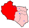
Birjand Constituency.png 1,552 × 1,500; 91 KB
-
Birjand County 1986.svg 490 × 551; 80 KB
-
Birjand County Map.svg 582 × 584; 17 KB
-
Birjand County.png 750 × 688; 25 KB
-
Boshruyeh County Map.svg 347 × 704; 16 KB
-
Boshruyeh County.png 750 × 688; 24 KB
-
Darmian County Map.svg 745 × 522; 15 KB
-
Darmian County.png 750 × 688; 24 KB
-
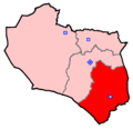
Ferdows Constituency.png 1,552 × 1,500; 92 KB
-
Ferdows County 1986.svg 382 × 470; 53 KB
-
Ferdows County Map.svg 515 × 662; 15 KB
-
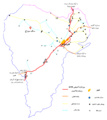
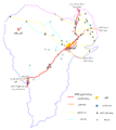
Ferdows County Roads.png 2,779 × 3,107; 593 KB
-
Ferdows County.png 750 × 688; 24 KB
-
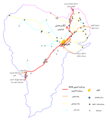
Ferdows Hole-in-the-Rock Location.png 2,817 × 3,163; 624 KB
-
Ferdows Hot Spring Location.png 2,817 × 3,163; 627 KB
-
IRAN-OSTAN-SOUTHKHORASAN.PNG 2,385 × 2,124; 306 KB
-
Khorasan 2020.svg 676 × 1,082; 153 KB
-
Khousf County.png 750 × 688; 25 KB
-
Khurasan division.svg 400 × 600; 18 KB
-
Khusf County Map.svg 397 × 629; 21 KB
-
Mapofkhorasan1775.png 1,952 × 2,144; 258 KB
-
Nehbandan Constituency.png 1,552 × 1,500; 91 KB
-
Nehbandan County Map.svg 774 × 729; 22 KB
-
Nehbandan County.png 750 × 688; 24 KB
-
NH 40-2 Ravar, Iran.jpg 5,000 × 3,772; 4.36 MB
-
NH 40-4 Chah-e Vak, Iran.jpg 5,000 × 3,848; 2.96 MB
-
NH 40-8 Ab Sard, Iran.jpg 5,000 × 3,799; 4.52 MB
-
NI 40-10 Tabas, Iran.jpg 5,000 × 3,780; 4.51 MB
-
NI 40-11 Boshruyeh, Iran.jpg 5,000 × 3,790; 3.46 MB
-
NI 40-12 Qayen, Iran.jpg 5,000 × 3,790; 4.04 MB
-
NI 40-14 Abdughi, Iran.jpg 5,000 × 3,792; 3.92 MB
-
NI 40-15 Khur, Iran.jpg 5,000 × 3,837; 2.7 MB
-
NI 40-16 Birjand, Iran.jpg 5,000 × 3,797; 3.46 MB
-
NI 40-6 Eshqabad, Iran.jpg 5,000 × 3,787; 3.45 MB
-
NI 40-7 Ferdows, Iran.jpg 5,000 × 3,837; 3.42 MB
-
NI 40-8 Juymand, Iran.jpg 5,000 × 3,808; 3.69 MB
-
NI 41-13 Gazik, Iran; Afghanistan.jpg 5,000 × 3,791; 2.84 MB
-
NI 41-9 Shahrakht, Iran; Afghanistan.jpg 5,000 × 3,795; 4.28 MB
-
Polond Desert Location.png 2,817 × 3,163; 624 KB
-
Qaen Constituency.png 1,552 × 1,500; 91 KB
-
Qaen County 1986.svg 570 × 336; 34 KB
-
Qaen County Map.svg 754 × 651; 18 KB
-
Qaen County.png 750 × 688; 24 KB
-
Sarayan County Map.svg 487 × 671; 13 KB
-
Sarayan County.png 750 × 688; 25 KB
-
Sarbisheh County Map.svg 713 × 416; 18 KB
-
Sarbisheh County.png 750 × 688; 24 KB
-
South Khorasan - grey.svg 438 × 417; 56 KB
-
South Khorasan Colored Persian-bg.png 750 × 702; 18 KB
-
South Khorasan Colored Persian.png 750 × 702; 35 KB
-
South Khorasan Colored.png 750 × 702; 23 KB
-
South Khorasan counties-ta.svg 438 × 417; 91 KB
-
South Khorasan fa.svg 810 × 780; 232 KB
-
South Khorasan Province 2020.svg 1,244 × 1,263; 40 KB
-
South Khorasan Province Constituencies.png 1,552 × 1,500; 90 KB
-
South Khorasan Province density 2020.svg 1,244 × 1,263; 35 KB
-
South Khorasan Province Map.svg 634 × 599; 222 KB
-
South Khorasan.png 339 × 285; 7 KB
-
South Khorasan.svg 810 × 780; 258 KB
-
Tabas County 1986.svg 420 × 571; 45 KB
-
Tabas County Map.svg 497 × 682; 145 KB
-
Tabas County.png 750 × 688; 25 KB
-
USGS Shakemap - 1997 Qayen earthquake.jpg 612 × 713; 160 KB
-
Zirkouh County.png 750 × 688; 24 KB
-
Zirkuh County Map.svg 865 × 614; 15 KB


