Category:Maps of Fars Province
Jump to navigation
Jump to search
- Provinces of Iran
- Alborz
- Ardabil
- Bushehr
- Chaharmahal and Bakhtiari
- East Azerbaijan
- Fars
- Gilan
- Golestan
- Hamadan
- Hormozgan
- Ilam
- Isfahan
- Kerman
- Kermanshah
- Khuzestan
- Kohgiluyeh and Boyer-Ahmad
- Kurdistan
- Lorestan
- Markazi
- Mazandaran
- North Khorasan
- Qazvin
- Qom
- Razavi Khorasan
- Semnan
- Sistan and Baluchestan
- South Khorasan
- Tehran
- West Azerbaijan
- Yazd
- Zanjan
Subcategories
This category has the following 6 subcategories, out of 6 total.
L
T
Media in category "Maps of Fars Province"
The following 57 files are in this category, out of 57 total.
-
 Fars in Iran.svg 512 × 457; 333 KB
-
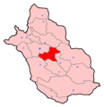
 Locator map Iran Fars Province.png 672 × 600; 131 KB
-
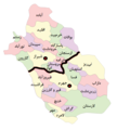
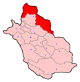 Abadeh Constituency.png 2,536 × 2,627; 144 KB
-
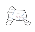
 Abadeh County Map-blank.png 854 × 793; 22 KB
-
 Abadeh County Map-fa.png 854 × 793; 33 KB
-
 Abadeh County Map-ug.png 854 × 793; 33 KB
-
 Ardakan Constituency (Fars province).png 2,536 × 2,627; 144 KB
-
 Bdrdthdg64646.jpg 1,536 × 2,048; 378 KB
-
 Darab Constituency.png 2,536 × 2,627; 144 KB
-
 Eqlid Constituency.png 2,536 × 2,627; 143 KB
-
 Fars fa.svg 760 × 780; 622 KB
-
 Fars hospital beds.svg 800 × 727; 155 KB
-
 Fars medical.png 500 × 491; 65 KB
-
 Fars medical.svg 838 × 771; 186 KB
-
 Fars province 1956.svg 694 × 875; 148 KB
-
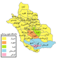
 Fars province 2020-names.svg 800 × 727; 299 KB
-
 Fars province 2020.svg 800 × 727; 155 KB
-
 Fars Province Constituencies.png 2,536 × 2,627; 142 KB
-
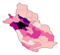 Fars province density 2020.svg 800 × 727; 155 KB
-
 Fars province in 2020.svg 800 × 727; 159 KB
-
 Fars province in 2022.svg 733 × 658; 160 KB
-
 Fars Province OpenStreetMap.PNG 929 × 972; 148 KB
-
 Fars Province relief OpenStreetMap.PNG 929 × 972; 1.38 MB
-
 Fars-clear.png 400 × 420; 99 KB
-
 Fars-e.jpg 712 × 723; 55 KB
-
 Fars.svg 760 × 780; 647 KB
-
 Fasa Constituency.png 2,536 × 2,627; 143 KB
-
 Firuzabad Constituency.png 2,536 × 2,627; 144 KB
-
 Iran location map jj.jpg 672 × 600; 80 KB
-
 Iran locator19.png 1,024 × 849; 48 KB
-
 IRAN-OSTAN-FARS.PNG 2,385 × 2,124; 305 KB
-
 IranFars.png 879 × 813; 25 KB
-
 Islamic state of laristan.png 279 × 223; 3 KB
-
 Jahrom Constituency.png 2,536 × 2,627; 144 KB
-
 Kazerun Constituency.png 2,536 × 2,627; 143 KB
-
 Lamerd Constituency.png 2,536 × 2,627; 144 KB
-
 Lar Constituency.png 2,536 × 2,627; 144 KB
-
 Map of Fars and it's surrounding regions-ar&fa.png 1,698 × 904; 1.41 MB
-
 Map of Fars and it's surrounding regions.png 1,698 × 904; 1.32 MB
-
 Map of the Sasanian province of Pars before Kavad I.svg 2,865 × 2,426; 4.99 MB
-
 Map of the Sasanian province of Pars fa.svg 2,865 × 2,496; 6.39 MB
-
 Map of the Sasanian province of Pars.svg 2,865 × 2,496; 6.69 MB
-
 Marvdasht Constituency.png 2,536 × 2,627; 144 KB
-
 Neyriz Constituency.png 2,536 × 2,627; 144 KB
-
 NG 39-4 Beyram, Iran.jpg 3,618 × 5,000; 4.35 MB
-
 NH 39-12 Shiraz, Iran.jpg 5,000 × 3,759; 4.77 MB
-
 NH 39-16 Jahrom, Iran.jpg 5,000 × 3,772; 5.03 MB
-
 NH 39-7 Ardakan, Iran.jpg 5,000 × 3,767; 4.62 MB
-
 NH 40-13 Darab, Iran.jpg 5,000 × 3,793; 4.81 MB
-
 North & South Fars.png 510 × 568; 64 KB
-
 Nurabad Constituency (Fars Province).png 2,536 × 2,627; 143 KB
-
 Rigobert Bonne. Perse. 1787 (P).jpg 971 × 693; 214 KB
-
 Sarvestan Constituency.png 2,536 × 2,627; 143 KB
-
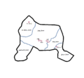
 Shahrestan-e Abade.png 1,281 × 878; 62 KB
-
 Shiraz Constituency.png 2,536 × 2,627; 143 KB
-
 جنگ قلعهٔ گراش - جانپولاد.jpg 2,214 × 1,471; 915 KB
-
 نقشه قصر ابونصر.jpg 3,000 × 4,000; 7.41 MB


.png)


.png)
.jpg)


