Category:Maps of Kohgiluyeh and Boyer-Ahmad Province
Jump to navigation
Jump to search
- Provinces of Iran
- Alborz
- Ardabil
- Bushehr
- Chaharmahal and Bakhtiari
- East Azerbaijan
- Fars
- Gilan
- Golestan
- Hamadan
- Hormozgan
- Ilam
- Isfahan
- Kerman
- Kermanshah
- Khuzestan
- Kohgiluyeh and Boyer-Ahmad
- Kurdistan
- Lorestan
- Markazi
- Mazandaran
- North Khorasan
- Qazvin
- Qom
- Razavi Khorasan
- Semnan
- Sistan and Baluchestan
- South Khorasan
- Tehran
- West Azerbaijan
- Yazd
- Zanjan
Media in category "Maps of Kohgiluyeh and Boyer-Ahmad Province"
The following 49 files are in this category, out of 49 total.
-
 Bakhsh haye ostan kohgiluyeh and boveir ahmad.svg 826 × 557; 367 KB
-
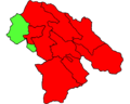
 Charam county - شهرستان چرام.jpg 1,846 × 1,477; 545 KB
-
 Cities of Kohgiluyeh and Boyer-Ahmad Province - 2.png 1,846 × 1,477; 146 KB
-
 Cities of Kohgiluyeh and Boyer-Ahmad Province.png 1,846 × 1,477; 165 KB
-
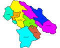
 Counties of kohgiluyeh and boyer ahmad by english name.svg 826 × 557; 222 KB
-
 Counties of kohgiluyeh and boyer ahmad by persian name.svg 826 × 557; 221 KB
-
 Counties of kohgiluyeh and boyer ahmad.svg 826 × 557; 216 KB
-
 Counties of Kohgiluyeh and Boyer-Ahmad Province - 2.png 1,846 × 1,477; 143 KB
-
 Counties of Kohgiluyeh and Boyer-Ahmad Province.png 1,846 × 1,477; 160 KB
-
 County seats of Kohgiluyeh and Boyer-Ahmad Province - 2.png 1,846 × 1,477; 135 KB
-
 County seats of Kohgiluyeh and Boyer-Ahmad Province.png 1,846 × 1,477; 148 KB
-
 Districts of kohgiluyeh and boveir ahmad counties by english name.svg 703 × 557; 272 KB
-
 Districts of kohgiluyeh and boveir ahmad counties by persian name.svg 703 × 557; 271 KB
-
 Districts of kohgiluyeh and boveir ahmad counties.svg 703 × 557; 422 KB
-
 Farming in kohgiluyeh and boveir ahmad.svg 826 × 557; 522 KB
-
 Forest of kohgiluyeh and boyer ahmad.svg 887 × 557; 458 KB
-
 Herbaceous plants of kohgiluyeh and boyer ahmad.svg 887 × 557; 459 KB
-
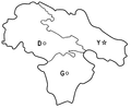 Kohgiluye.PNG 1,013 × 833; 48 KB
-
 Kohgiluyeh and boveir ahmad by hectars.svg 826 × 557; 377 KB
-
 Kohgiluyeh and boyer ahmad i unit.svg 703 × 557; 885 KB
-
 Kohgiluyeh and boyer ahmad land form.svg 826 × 557; 1.21 MB
-
 Kohgiluyeh and Boyer-Ahmad fa.svg 860 × 780; 297 KB
-
 Kohgiluyeh and Boyer-Ahmad Province - استان کهگیلویه و بویر احمد.jpg 1,846 × 1,477; 418 KB
-
 Kohgiluyeh and Boyer-Ahmad.svg 860 × 780; 311 KB
-
 Map of kohgiluyeh and boyer ahmad.svg 1,139 × 581; 97 KB
-
 Map of Kohgiluyeh and Boyer-Ahmad Province - نقشه استان کهگیلویه و بویر احمد.png 1,846 × 1,477; 140 KB
-
 NH 39-7 Ardakan, Iran.jpg 5,000 × 3,767; 4.62 MB
-
 Residential areas of kohgilueh and boyer ahmad.svg 958 × 581; 272 KB
-
 Rivers of kohgiluyeh and boyeir ahmad.svg 826 × 557; 592 KB
-
 Rivers of kohgiluyeh and boyer ahmad.svg 958 × 581; 539 KB
-
 شهر های استان کهگیلویه و بویر احمد - 2.png 1,846 × 1,477; 154 KB
-
 شهر های استان کهگیلویه و بویر احمد.png 1,846 × 1,477; 138 KB
-
 شهرستان باشت - Basht county.png 1,846 × 1,477; 126 KB
-
 شهرستان بهمئی - Bahmai county.png 1,846 × 1,477; 127 KB
-
 شهرستان بویراحمد - BoyerAhmad county.png 1,846 × 1,477; 131 KB
-
 شهرستان دنا - Dana county.png 1,846 × 1,477; 128 KB
-
 شهرستان لنده - Landeh county.png 1,846 × 1,477; 125 KB
-
 شهرستان چرام - Choram county - 2.png 1,846 × 1,477; 127 KB
-
 شهرستان چرام - choram county - 3.png 1,846 × 1,477; 133 KB
-
 شهرستان چرام - choram county - 4.png 1,846 × 1,477; 133 KB
-
 شهرستان چرام - choram county - 5.png 1,846 × 1,477; 131 KB
-
 شهرستان چرام - Choram county.png 1,846 × 1,477; 143 KB
-
 شهرستان کهگیلویه - Kohgiluyeh county.png 1,846 × 1,477; 128 KB
-
 شهرستان گچساران - Gachsaran county.png 1,846 × 1,477; 127 KB
-
 نقشه استان کهگیلویه و بویر احمد - 2.png 1,846 × 1,477; 144 KB
-
 نقشه استان کهگیلویه و بویر احمد - Map of Kohgiluyeh and Boyer-Ahmad Province - 2.png 1,846 × 1,477; 127 KB
-
 نقشه استان کهگیلویه و بویر احمد - Map of Kohgiluyeh and Boyer-Ahmad Province - 3.png 1,846 × 1,477; 139 KB
-
 نقشه استان کهگیلویه و بویر احمد.png 1,846 × 1,477; 162 KB
-
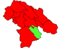
 نقشه تقسیمات سیاسی استان کهگیلویه و بویراحمد.jpg 1,004 × 713; 263 KB


