Category:Maps of East Patagonia Dispute
Jump to navigation
Jump to search
Media in category "Maps of East Patagonia Dispute"
The following 14 files are in this category, out of 14 total.
-
-
 BarrosArana.jpg 4,912 × 3,504; 2.2 MB
-
 Chile.CarlosPrieto.1881.jpg 4,754 × 3,456; 1.93 MB
-

-

-

-
 Informe-Diego-Barros-Arana.1890.jpg 4,009 × 3,518; 1.34 MB
-
 Kingsaward.1902.jpg 4,816 × 3,470; 2.12 MB
-
 Londres1888.jpg 4,132 × 2,909; 1.85 MB
-
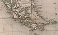
 Mapa Canal del Beagle, 1888.jpg 797 × 418; 119 KB
-
 Mapa Canal del Beagle, 1888.orografico.jpg 1,608 × 928; 467 KB
-
 PazSoldan-Bayer-Block.1887.jpg 4,966 × 3,314; 2.08 MB
-
 Sector del mapa South America. Southern Sheet. Keith Johnston, 1861.jpg 640 × 826; 155 KB
-
 Seelstrang.1875-section.jpg 1,936 × 1,176; 466 KB
.jpg)


.svg)
.svg)
%27_(11249124685).jpg)


