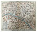
Category:Maps of Paris in the 20th century
Jump to navigation
Jump to search
Subcategories
This category has the following 13 subcategories, out of 13 total.
- Maps of Paris in the 1910s (42 F)
- Maps of Paris in the 1920s (29 F)
- Maps of Paris in the 1930s (22 F)
- Maps of Paris in the 1940s (10 F)
- Maps of Paris in the 1990s (17 F)
2
N
Media in category "Maps of Paris in the 20th century"
The following 11 files are in this category, out of 11 total.
-
Plan fortifications place de Paris.JPG 826 × 530; 678 KB
-
Guilmin map of Paris, France, Monuments - Geographicus - Paris-Guilmin.jpg 5,000 × 3,680; 5.84 MB
-
Historical map of Paris Metro - 1899-2012 reduced.gif 977 × 897; 9.36 MB
-
Historical map of Paris Metro - 1899-2012.gif 4,282 × 3,933; 50.5 MB
-
Ottův slovník naučný - Paříž 01.JPG 2,302 × 2,016; 3.44 MB
-
Ottův slovník naučný - Paříž 02.JPG 2,510 × 2,115; 3.5 MB
-
Paris.carte d'arrondissement.A16N.jpg 1,328 × 1,076; 533 KB
-
Paris.carte d'arrondissement.A16S.jpg 1,322 × 1,096; 515 KB
-
Plan de Paris, la ville contemporaine. D.17228.jpg 3,000 × 2,263; 1.59 MB
-
Traces de l'enceinte primitive dans le parcellaire du XIX et XXe siècle.svg 1,486 × 922; 453 KB


