
Category:Maps of Paris in the 1940s
Media in category "Maps of Paris in the 1940s"
The following 10 files are in this category, out of 10 total.
-
 Population density of Paris, 1946 - Demographia.svg 512 × 293; 185 KB
-

-
 Carte guide des bons coins de pêche de l'Ile-de-France, 1948 (verso) - Gallica.jpg 8,806 × 6,370; 7.13 MB
-
 Carte guide des bons coins de pêche de l'Ile-de-France, 1948 - Gallica.jpg 8,806 × 6,370; 8.48 MB
-
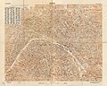
 Girard et Barrère, Paris, 1945 - Gallica.jpg 10,340 × 7,454; 16.3 MB
-
 Paris - DPLA - daad9e98b57073f044ef9ef1b676edd9.jpg 4,343 × 3,289; 2.41 MB
-
 Services d'architecture et d'urbanisme, Ville de Paris. Plan des servitudes, 1948 - Gallica.jpg 11,048 × 8,760; 15.91 MB
-
 U.S. Army Map Service, Paris 1944 - Mapster.jpg 16,000 × 13,655; 38.6 MB
-
 U.S. Army Map Service, Paris 1944 - The University of Texas at Austin.jpg 6,560 × 5,242; 15.53 MB
-
 War Office (Great Britain) - Paris, 1944 - McMaster University.jpg 23,018 × 16,782; 222.47 MB


_-_Gallica.jpg)


_-_Paris,_1944_-_McMaster_University.jpg)