Category:Maps of Paris in the 1760s
Jump to navigation
Jump to search
Subcategories
This category has the following 5 subcategories, out of 5 total.
D
- Plan de Deharme (1763) (11 F)
P
Media in category "Maps of Paris in the 1760s"
The following 40 files are in this category, out of 40 total.
-
 Seutter 1760 paris cropped.jpg 2,195 × 1,824; 3.61 MB
-
 Seutter 1760 paris.jpg 2,260 × 1,948; 2.21 MB
-
 1760 Plan de Delagrive.jpg 5,466 × 3,731; 7.63 MB
-
 Jaillot map of Paris 1762 - Gallica.jpg 7,301 × 4,971; 12.19 MB
-
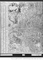 Plan Paris Jaillot nord.jpg 512 × 714; 98 KB
-
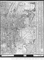 Plan Paris Jaillot sud.jpg 512 × 699; 96 KB
-
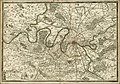 1762 map of the surroundings of Paris.jpg 6,080 × 4,268; 6.18 MB
-
 Karta över Paris indelat i 20 distrikt, tryckt 1763 - Skoklosters slott - 86164.jpg 3,093 × 2,668; 7.63 MB
-
 Karta över Paris indelat i 20 distrikt, tryckt 1763 - Skoklosters slott - 86164.tif 3,093 × 2,668, 2 pages; 18.05 MB
-
 Atlas des anciens plans de Paris - 095. Paris en 1760 - David Rumsey.jpg 24,827 × 17,328; 122.07 MB
-
 Atlas des anciens plans de Paris - 096. Paris en 1763 - David Rumsey.jpg 17,900 × 25,022; 126.52 MB
-
 Atlas des anciens plans de Paris - 097. Paris en 1763 - David Rumsey.jpg 17,712 × 24,696; 118.01 MB
-
 Atlas des anciens plans de Paris - 098. Paris en 1763 - David Rumsey.jpg 32,151 × 25,000; 230.98 MB
-
 Atlas des anciens plans de Paris - Paris en 1760 - BHVP.jpg 5,178 × 3,474; 6.44 MB
-
 Atlas des anciens plans de Paris - Paris en 1760 - David Rumsey.jpg 20,600 × 14,000; 182.99 MB
-
 Atlas des anciens plans de Paris - Paris en 1763 - BHVP.jpg 7,328 × 4,543; 33.45 MB
-
 Atlas des anciens plans de Paris - Paris en 1763 - David Rumsey.jpg 30,000 × 18,500; 338.14 MB
-
 Atlas des anciens plans de Paris - Paris en 1763 A - BHVP.jpg 3,791 × 4,556; 6.24 MB
-
 Atlas des anciens plans de Paris - Paris en 1763 B - BHVP.jpg 3,828 × 4,634; 6.48 MB
-
 Emplacement des huit cimetières. Arrêt du Parlement, 21 mai 1765. F. G. del. - BHVP.jpg 3,363 × 2,761; 1.18 MB
-
 Environs de Paris Vaugondy 1761 jms.jpg 8,192 × 6,722; 17.85 MB
-
 Jean Lattré, Plan de la ville de Paris et de ses Faubourgs, 1765 - Gallica.jpg 9,696 × 6,912; 13.94 MB
-
 Jean-Baptiste Nolin, Plan routier de la ville et faubourg de Paris, 1761 - Gallica.jpg 10,596 × 7,997; 15.97 MB
-
 Karta över Paris indelat i 20 distrikt, tryckt 1763 - Skoklosters slott - 86165.tif 3,810 × 2,470; 19.97 MB
-
 Karta över Paris indelat i 20 distrikt, tryckt 1763 - Skoklosters slott - 86166.tif 3,836 × 2,390; 19.55 MB
-
 Karta över Paris indelat i 20 distrikt, tryckt 1763 - Skoklosters slott - 86167.tif 3,804 × 2,498; 17.81 MB
-
 Karta över Paris indelat i 20 distrikt, tryckt 1763 - Skoklosters slott - 86168.tif 5,658 × 3,510; 56.84 MB
-
 Kartbok över Paris indelat i 20 distrikt, tryckt 1763 - Skoklosters slott - 86169.tif 4,176 × 2,572; 21.35 MB
-
 Louis-Charles Desnos, Nouveau Plan de Paris, ses faubourgs et ses environs, 1767 - Gallica.jpg 9,245 × 6,878; 16.35 MB
-
 Louis-François Deharme, Plan de la Ville et Fauxbourgs de Paris, 1766 - David Rumsey.jpg 49,522 × 30,102; 494.62 MB
-
-
 Nouveau plan de Paris ses faubourgs et ses environs, 1769 - Paris Musées.jpg 13,672 × 7,623; 75.64 MB
-
 Pariskarta från 1763 - Skoklosters slott - 86268.tif 5,893 × 3,906; 65.88 MB
-
 Plan de la Riviere de Seine dans Paris (2674743637).jpg 2,000 × 1,623; 2.73 MB
-
 Plan de la Riviere de Seine dans Paris, 1760 - Norman B. Leventhal Map Center.tif 4,192 × 3,400; 40.81 MB
-
 Plan de la Riviere de Seine dans Paris, 1760.jpg 4,192 × 3,400; 6.35 MB
-
 Plan de la ville et des faubourgs de Paris by Robert de Vaugondy, 1766 - Stanford Libraries.jpg 13,399 × 9,003; 25.5 MB
-
 Plan de la ville et des faubourgs de Paris by Robert de Vaugondy, 1766 - Stanford Libraries.tif 13,399 × 9,003; 115.07 MB
-
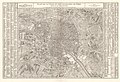
 Plan de Vaugondy edited.jpg 1,515 × 1,239; 1.57 MB
-
 Rue Saint-Georges 1760.jpg 685 × 481; 248 KB


.jpg)


