Category:Maps of Paris in the 1770s
Jump to navigation
Jump to search
Subcategories
This category has the following 2 subcategories, out of 2 total.
P
Media in category "Maps of Paris in the 1770s"
The following 21 files are in this category, out of 21 total.
-
 1770 – Carte des Environs de Paris par Bonne.jpg 5,712 × 3,904; 2.94 MB
-
 1772 map of Paris by Louis Charles Desnos.jpg 7,982 × 4,473; 8.62 MB
-
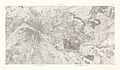
 1773 – Carte des Chasses du Roy en 4 feuilles.jpg 4,370 × 2,399; 8.98 MB
-
 1773 – Carte des Chasses du Roy en 5 feuilles.jpg 4,476 × 3,796; 13.8 MB
-
 1773 – Carte des Chasses du Roy.jpg 10,072 × 5,858; 65.87 MB
-

-
 1776 - Li Contorni di Parigi. 1776 - Open Data Hauts-de-Seine.jpg 6,176 × 4,800; 4.15 MB
-
 1777 – Nouveau Plan des environs de Paris.jpg 9,260 × 6,350; 30.12 MB
-
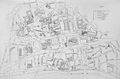
 Ancien quartier Saint-André des Arts à Paris (1774) (A05).jpg 1,846 × 2,618; 1.3 MB
-
 Antonio Zatta, Li Contorni di Parigi, 1776 - David Rumsey.jpg 8,880 × 6,380; 42.15 MB
-
 Antonio Zatta, Li Contorni di Parigi, 1776 - Gallica.jpg 7,788 × 5,421; 7.47 MB
-
 Jaillot, Nouveau Plan de la ville et fauxbourgs de Paris, 1777 - Gallica.jpg 8,576 × 7,004; 6.15 MB
-
 Jaillot, Nouveau plan de la ville et fauxbourgs de Paris, 1778 - David Rumsey.jpg 39,593 × 34,109; 543.95 MB
-

-
 Jean Lattré, Plan routier de la ville et faubourg de Paris, 1774 - Gallica.jpg 9,217 × 6,650; 16.08 MB
-
 Jean Lattré, Plan routier de la ville et faubourg de Paris, 1779 - Gallica.jpg 9,189 × 6,678; 16.29 MB
-
 L'Université de Paris, 1880.jpg 4,550 × 3,009; 7.19 MB
-
 Le Palais Royal et ses environs 1770-1795.jpg 3,599 × 2,706; 4.88 MB
-
 Louis-Charles Desnos, Nouveau plan de Paris, ses faubourgs et ses environs, 1770 - Gallica.jpg 12,310 × 6,746; 17.54 MB
-
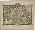 Moithey, Plan de la ville et faubourgs de Paris, 1771 - Gallica.jpg 6,131 × 5,234; 6.4 MB
-


_(A05).jpg)


