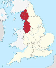
Category:Maps of North West England
Jump to navigation
Jump to search
Wikimedia category | |||||
| Upload media | |||||
| Instance of | |||||
|---|---|---|---|---|---|
| Category combines topics | |||||
| North West England | |||||
region of England | |||||
| Instance of | |||||
| Location | England | ||||
| Population |
| ||||
| Area |
| ||||
| official website | |||||
 | |||||
Subcategories
This category has the following 9 subcategories, out of 9 total.
C
G
L
M
O
Media in category "Maps of North West England"
The following 42 files are in this category, out of 42 total.
-
A57(M) motorway in North West England map.svg 393 × 565; 417 KB
-
A601(M) motorway in North West England map.svg 393 × 565; 417 KB
-
A627(M) motorway in North West England map.svg 393 × 565; 418 KB
-
England Region - North West.svg 525 × 650; 83 KB
-
EnglandNorthWest.png 200 × 247; 15 KB
-
Former M63 motorway in North West England map.svg 393 × 565; 414 KB
-
Liverpool to Manchester map.png 1,242 × 417; 896 KB
-
M53 motorway in North West England map.svg 393 × 565; 417 KB
-
M55 motorway in North West England map.svg 393 × 565; 418 KB
-
M56 motorway in North West England map.svg 393 × 565; 417 KB
-
M57 motorway in North West England map.svg 393 × 565; 417 KB
-
M58 motorway in North West England map.svg 393 × 565; 417 KB
-
M60 motorway in North West England map.svg 393 × 565; 417 KB
-
M602 motorway in North West England map.svg 393 × 565; 417 KB
-
M61 motorway in North West England map.svg 393 × 565; 417 KB
-
M65 motorway in North West England map.svg 393 × 565; 418 KB
-
M66 motorway in 1998 in North West England map.svg 393 × 565; 418 KB
-
M66 motorway in North West England map.svg 393 × 565; 417 KB
-
M67 motorway in North West England map.svg 393 × 565; 417 KB
-
Map of Northern England.png 1,479 × 1,080; 301 KB
-
Motorways in North West England map.svg 393 × 565; 435 KB
-
North West England (European Parliament constituency).svg 641 × 1,173; 206 KB
-
North West England constituencies 2011 map.svg 674 × 1,345; 1.59 MB
-
North West England counties 2009 map.svg 674 × 1,345; 1.39 MB
-
North West England counties 2023 map.svg 674 × 1,345; 1.38 MB
-
North West England counties.png 1,341 × 2,685; 306 KB
-
North West England districts 2011 map.svg 674 × 1,345; 1.34 MB
-
North West England in England.png 814 × 953; 107 KB
-
North West England in England.svg 816 × 991; 996 KB
-
North West England map.png 2,881 × 3,501; 1.58 MB
-
North West England map.svg 1,385 × 1,705; 3.09 MB
-
North West England wards 2011 map coloured.svg 674 × 1,345; 3.74 MB
-
North West England wards 2011 map.svg 674 × 1,345; 3.75 MB
-
North West England, Kurdish population (2011).svg 674 × 1,345; 1.34 MB
-
Northern England within the UK.png 1,821 × 3,089; 754 KB
-
Northern England.svg 816 × 991; 594 KB
-
NUTS 3 regions of North West England 2010 map.svg 674 × 1,345; 1.37 MB
-
NUTS 3 regions of North West England 2015 map.svg 674 × 1,345; 1.3 MB
-
NUTS 3 regions of North West England map.svg 674 × 1,345; 1.37 MB
-
Photo of Post Office Journal Radio telephone Map.png 573 × 785; 303 KB
-
Piel Island.png 719 × 685; 838 KB
-
United Kingdom AV referendum North West England results.svg 674 × 1,345; 1.34 MB


