Category:1775 maps of North Carolina
Jump to navigation
Jump to search
States of the United States: Massachusetts · New Jersey · New York · North Carolina · Pennsylvania · South Carolina · Virginia
| 1775 1777 |
Media in category "1775 maps of North Carolina"
The following 10 files are in this category, out of 10 total.
-

-

-
-

-
-

-

-

-

-
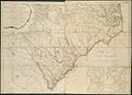
 An Accurate Map of North and South Carolina With Their Indian Frontiers.png 768 × 694; 1.05 MB
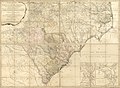
ins,_rivers,_swamps,_marshes,_bays,_creeks,_harbours,_sandbanks_and_soundings_on_LOC_gm71002153.jpg)
.jpg)


