Category:Maps of Namur (province)
Jump to navigation
Jump to search
Wikimedia category | |||||
| Upload media | |||||
| Instance of | |||||
|---|---|---|---|---|---|
| Category combines topics | |||||
| Province of Namur | |||||
province in Wallonia, Belgium | |||||
| Pronunciation audio | |||||
| Instance of | |||||
| Part of | |||||
| Named after | |||||
| Location | Walloon Region, Belgium | ||||
| Capital | |||||
| Official language | |||||
| Head of government |
| ||||
| Highest point | |||||
| Population |
| ||||
| Area |
| ||||
| Elevation above sea level |
| ||||
| official website | |||||
 | |||||
Provinces of Belgium: Province of Antwerp · Brussels-Capital Region · East Flanders · Flemish Brabant · Province of Liege · Luxembourg · Province of Namur · Walloon Brabant · West Flanders
Subcategories
This category has the following 42 subcategories, out of 42 total.
A
- Maps of Andenne (5 F)
- Maps of Anhée (4 F)
- Maps of Assesse (3 F)
B
- Maps of Beauraing (2 F)
- Maps of Bièvre (3 F)
C
- Maps of Ciney (2 F)
D
- Maps of Doische (2 F)
E
- Maps of Éghezée (3 F)
F
- Maps of Fernelmont (2 F)
- Maps of Floreffe (5 F)
- Maps of Florennes (5 F)
- Maps of Fosses-la-Ville (3 F)
G
- Maps of Gedinne (16 F)
- Maps of Gembloux (5 F)
- Maps of Gesves (3 F)
H
- Maps of Hamois (2 F)
- Maps of Hastière (2 F)
- Maps of Havelange (2 F)
- Maps of Houyet (2 F)
J
L
M
- Maps of Mettet (2 F)
N
O
- Maps of Ohey (2 F)
- Maps of Onhaye (2 F)
P
- Maps of Profondeville (2 F)
R
S
- Maps of Sambreville (2 F)
- Maps of Sombreffe (2 F)
- Maps of Somme-Leuze (2 F)
V
- Maps of Viroinval (3 F)
W
Y
- Maps of Yvoir (3 F)
Pages in category "Maps of Namur (province)"
This category contains only the following page.
Media in category "Maps of Namur (province)"
The following 31 files are in this category, out of 31 total.
-
Beauraing Namur Belgium Map.png 230 × 275; 4 KB
-
Belgienamen.png 398 × 335; 6 KB
-
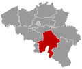
Belgium Namur location map.svg 500 × 583; 93 KB
-
BelgiumNamur.png 398 × 335; 7 KB
-
Bièvre Namur Belgium Map.png 230 × 275; 4 KB
-
Buurtspoorwegen Namen.png 1,939 × 1,833; 1.8 MB
-
Carte de la région Namur (villes Bioul et Dinant).png 741 × 724; 1.56 MB
-
Carte Floreffe (Floreffe).svg 659 × 589; 21 KB
-
Carte Floriffoux (Floreffe).svg 659 × 589; 21 KB
-
Couvin Namur Belgium Map.png 230 × 275; 4 KB
-
Dinant Namur Belgium Map.png 230 × 275; 6 KB
-
Forts at Namur, 1914.jpg 964 × 653; 80 KB
-
Houyet Namur Belgium Map.png 230 × 275; 4 KB
-
Judicial Arrondissement Dinant Belgium Map.PNG 230 × 275; 6 KB
-
Map of Northern champenois.jpg 878 × 618; 83 KB
-
Namenbevolkingsdichtheid.PNG 533 × 462; 17 KB
-
Namurbevolkingsdichtheid.PNG 533 × 462; 21 KB
-
NamurBevolkingsgroei18462016.png 533 × 462; 23 KB
-
NamurBevolkingsgroei19702016.png 539 × 485; 24 KB
-
NMVB Zuid Namen (cropped, Nouzon–Gespunsart–Corbion).png 1,661 × 750; 220 KB
-
NMVB Zuid Namen (cropped, Tremblois-lès-Rocroi–Petite-Chapelle).png 1,841 × 1,953; 360 KB
-
NMVB Zuid Namen.png 3,420 × 2,611; 1.13 MB
-
Ohey Namur Belgium Map.png 230 × 275; 4 KB
-
Plan des lignes de tramway dans la province de Flandre-Orientale 1950-01-01.jpg 1,041 × 914; 492 KB
-
Province de Namur in Belgium.svg 1,136 × 988; 371 KB
-
Province di Nameur (eplaeçmint).png 270 × 159; 2 KB
-
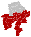
Province of Namur (Belgium) location.svg 1,136 × 945; 202 KB
-
Provinz Namur 2019.png 1,136 × 990; 326 KB
-
Rochefort Namur Belgium Map.png 230 × 275; 4 KB
-
Vresse-sur-Semois Namur Belgium Map.png 230 × 275; 4 KB
-
Wikivoyage map Namur.png 501 × 584; 173 KB


